Foothills Trail Flood
* Enumclaw
North
* Enumclaw
South
* Enumclaw
Undeveloped Section *
* Buckley
North
* Buckley
South
* Cascade
Junction Trail
* C
J Trail 2
* Cascade
Junction Bridge
*
* Carbonado * Wilkeson * South Prairie
East *
South
Prairie West
* Orting
East *
Orting
West *
* Other
Users
* Volunteers * Foothills
Trail Coalition
* Foothills
Trail Map
* Flooded
Foothills Trail
*
* Introduction * Wheels
in the Garden
* Wheels
Outside the Garden
* Foothills
TOT *
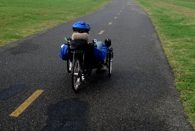
Foothills Trail Flood,
December 13, 2010
 |
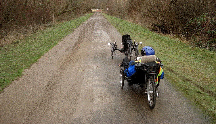
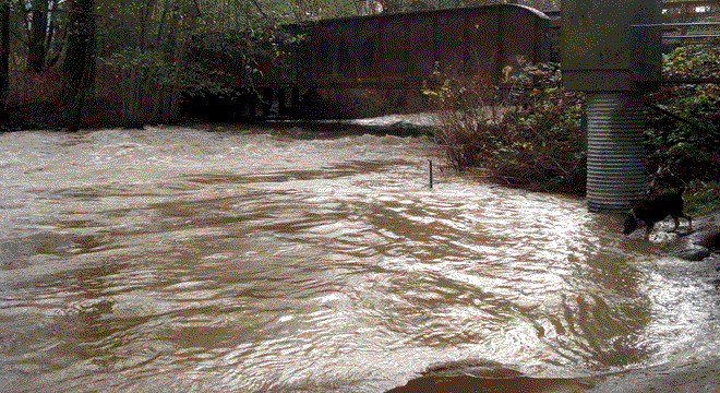
This year's Foothills Trail flood was much
tamer than the ones in 2008 (below) and 2009, but still made
for an exciting ride. |
|
The overflow of the wetlands created a sideways
current as well as deep water. |
 |
Foothills Trail Flood,
November 12, 2008
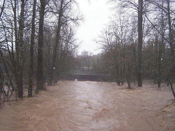
On November 12, 2008, several rivers in
the area flodded. Skies cleared the following morning, so I decided
to see how the Foothills trail fared. The road from South Prairie
to Orting was closed by deep water, but the trail remained open.
 |
The converted rail bridge over South Prairie
Creek ("creek" might be a minimalist descriptor) is
the current eastern terminis of the Foothills Trail. The water
level is usually about eight feet below the bridge. |
|
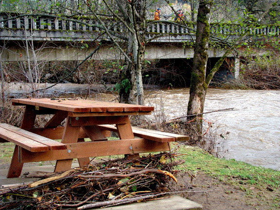
The creek had dropped several feet during
the night, leaving debris piled up against the anchored picnic
tables and a thick layer of mud in Veterans' Park. Engineers
from the U.S. Geological Survey monitor the flow from the highway
bridge.
A much worse flood a month later placed
tree trunks and roots on topof the tables. |
 |
 |
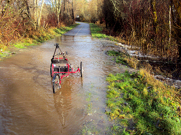
Despite the ominous creek, I headed out onto
the trail, with no signs of the flooding other than a few damp
spots. That situation soon changed. |
|
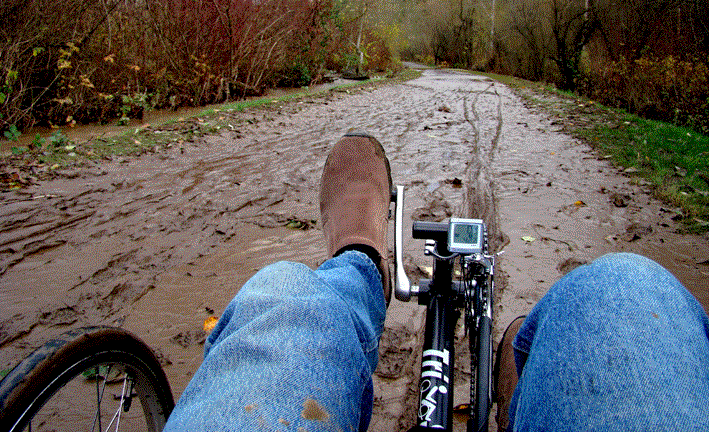
A deep layer of mud is the first sign of flooding
on the trail. These four inches were deposited on the pavement
the night before. |
|
In a few places, South Prairie Creek is actualy
higher than the trail, at least during flood stage. The brush
and a soggy bank work like a dike. |
|
|
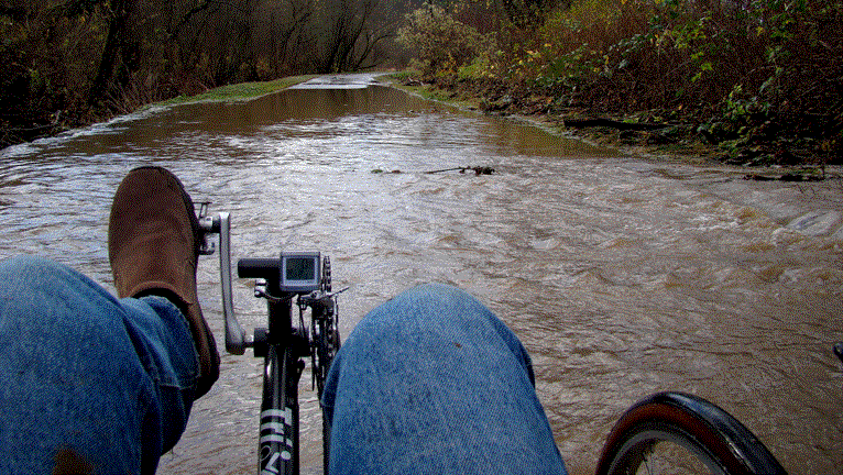
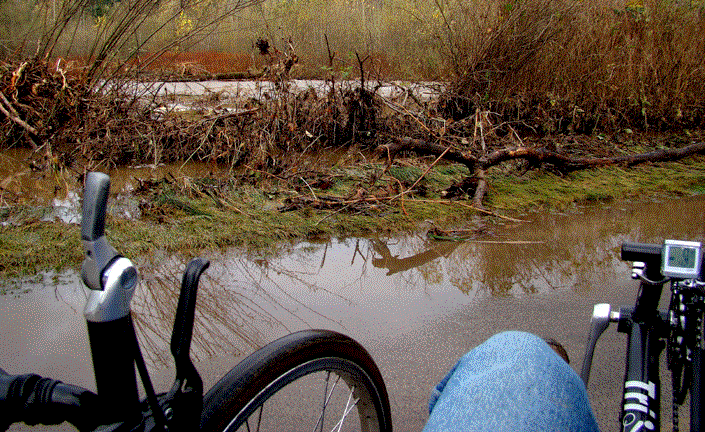
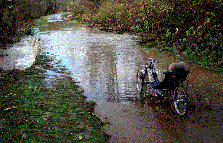
Anywhere there is an opening, the silty
water pours through dumps over the embankment on the opposite
side.
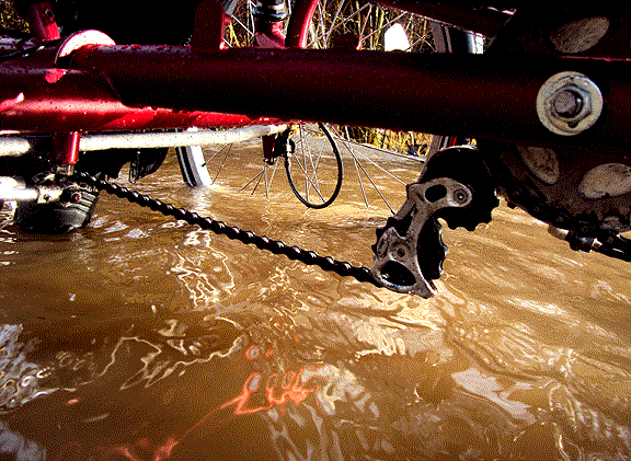
I venture through slowly, feeling the cold
water rise above the level of my seat bottom. |
|
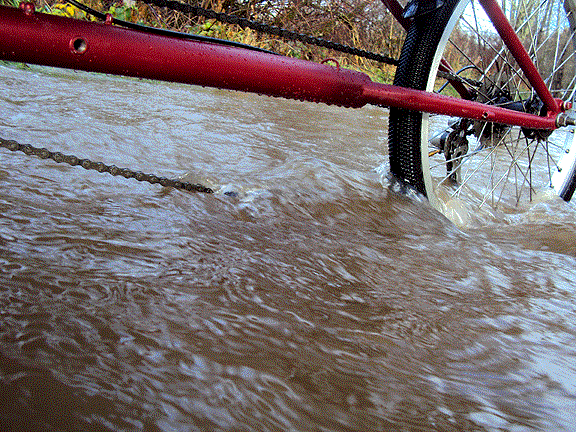
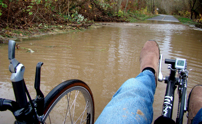
I reach the other side and turn back for
a closer look. The current moves quite fast across the trail,
which acts as a spillway off the old railroad grade.
In the flood a month later, this section
of the trail was gone and a long stretch closed. |
|
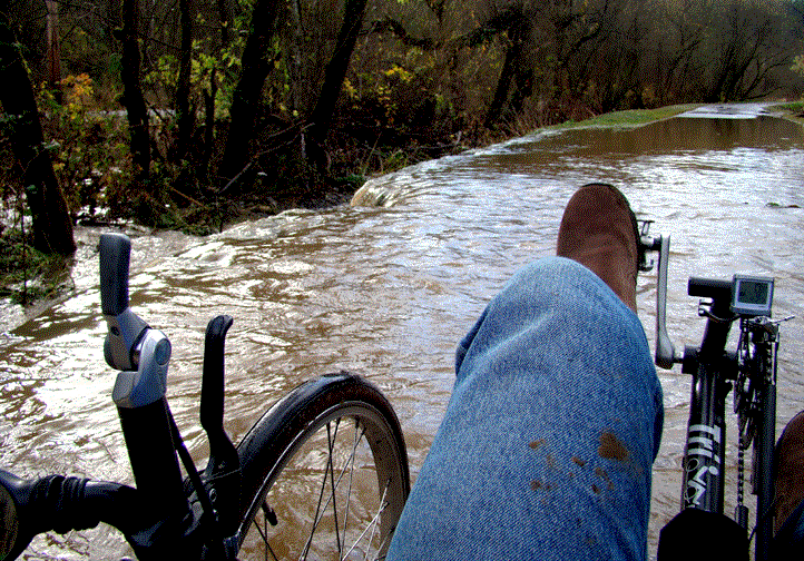
|
The front wheels pull as I first head into
the fastest current, but even out once there is equal pressure
on the front and back of the them.
Erosion is beginning in one spot. Hopefully
the water will drain before it reaches the pavement. |
|
A month later, a Pineapple Express storm brought a deluge of warm rain and mountain snowmelt for a much worse flood.
The trail closure below prevented entry into the area pictured above.  Below that is the reason.