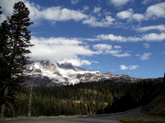
Stevens Canyon Road is a 19 mile descent from Paradise to the eastern entrance to Mt. Rainier National Park, including the first two miles on the one-way Paradise Valley Road. It is longer, and not as steep, as Paradise to Longmire or Sunrise to the White River Campground, but it is still easy to go 35 mph or more much of the way just by coasting. The ride includes spectacular views of Mt. Rainier and the Cascades, several lakes, cliffs, tunnels, and the Box Canyon. Box Canyon is also a good stopping point, since the final leg to the Grove of the Patriarchs includes a three-mile uphill.
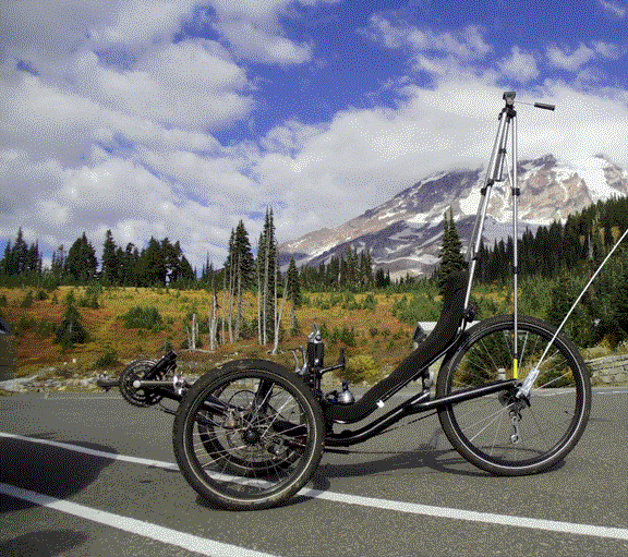
You can begin at Paradise, where restrooms and water are available. There restored lodge is open in summers, with rooms, a restaurant, and gift shop; the nearby visitor center is also open during the summer, and on weekends in spring and fall.
October is the best time to ride the roads in the park since they are nearly traffic-free.
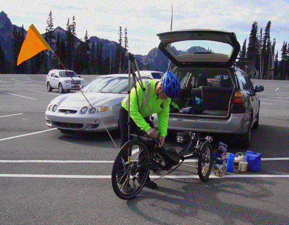
Climbing the Stevens Canyon Road is somewhat difficult, but you can coast most of the descents. It does have a few level stretches, but is mostly downhill. Shuttles work well for downhill only people, and a following mothership can mean you don't have to carry anything.
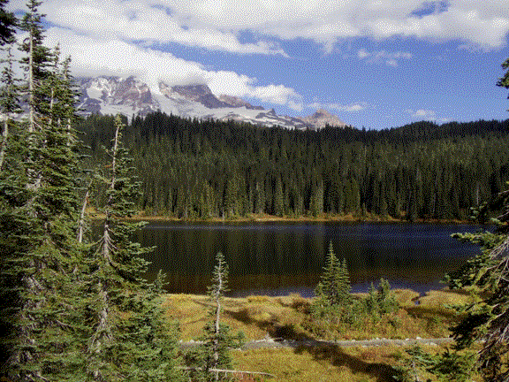
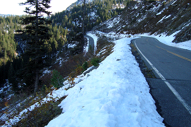
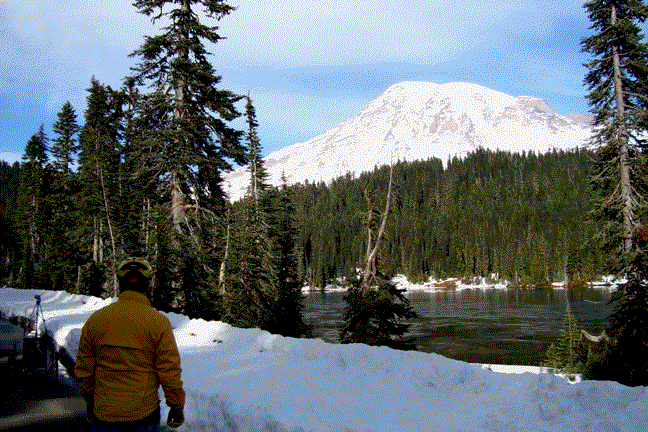
Following the two-mile Paradise Valley Road descent, the Stevens Canyon Road levels for a short way to some viewpoints and then the Reflection Lakes, a good first stop. This is the site of some of many classic Mt. Rainier photographs. As soon as you leave the lakes, the road follows the canyon, first with dropoffs on the left, then a hairpin turn, across the mouth of the canyon, and then a long run on the edge of huge rock cliffs. (The pictures above and below were taken on two rides a few days apart--the end of October and the beginning of November. The Paradise Valley road was closed, so we took the Paradise-Longmire route for the first mile to the intersection.)
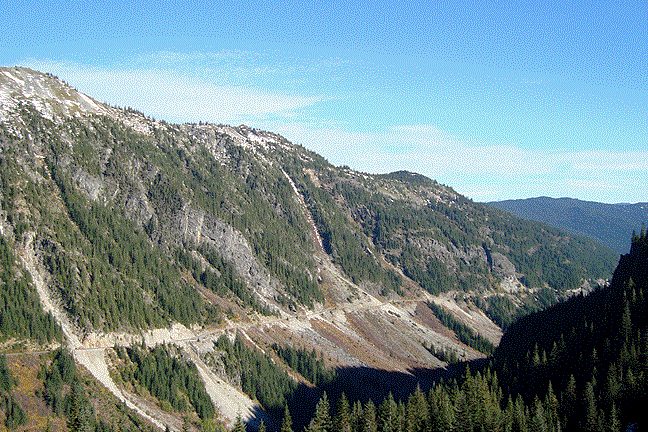
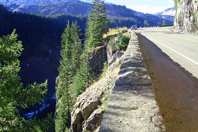
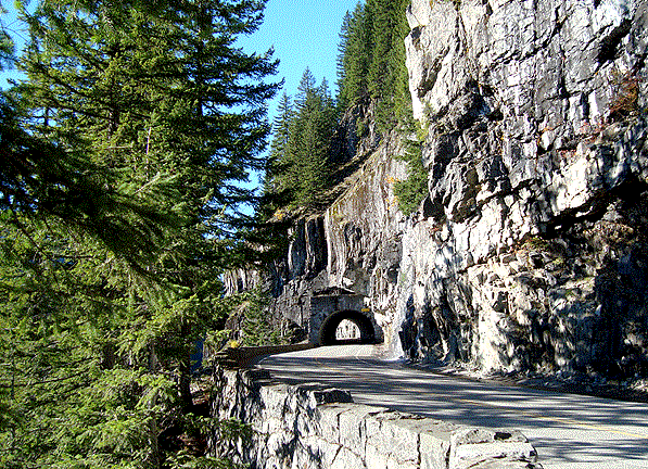
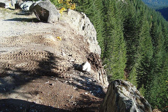
The road is carved out of rock cliffs, with dropoffs ranging from steep to vertical. The tunnel below was the easiest way to route the road around a protruding precipice.
Large rocks sometimes fall from the cliffs and must be lifted to dump trucks by huge loaders. The intrepid truck drivers then back to the edge of the abyss and send the boulders to the valley below.
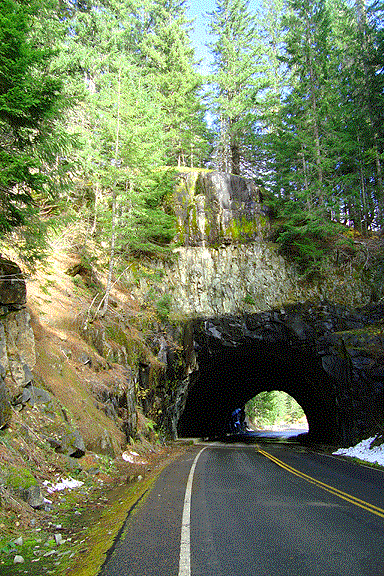 |
Another tunnel bores through the bedrock to the Box Canyon.
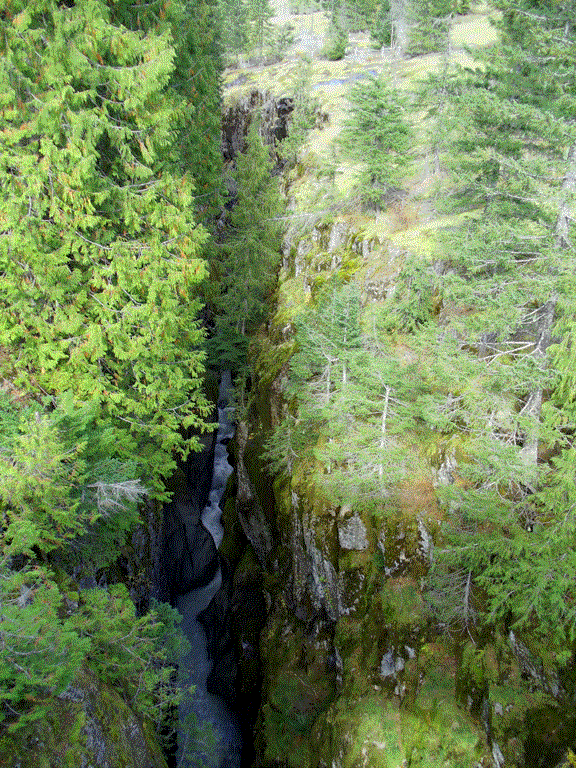
The Cowlitz River also cuts through the rock, and here it has a channel 180 feet deep but only six feet wide in places. |
The Box Canyon is a good stopping point, or you can keep going another ten miles to the park entrance.
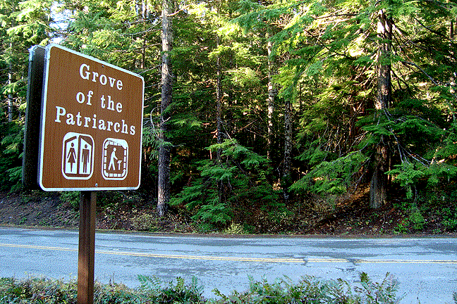
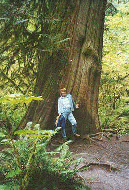
The Grove of the Patriarchs trail is a short side trip (on foot) by the park entrance. The one mile stroll takes you across a suspension bridge to an island in the Ohanapecosh River. The surrounding water protected the trees from periodic forest fires, so several 1000 year old specimens of various species crowd together in the small space. This is a worthwhile way to get your legs back after a 19 mile ride.