Foothills Trail: South Prairie East

* Enumclaw North * Enumclaw South * Enumclaw Undeveloped Section *

* Buckley North * Buckley South * Cascade Junction Trail * C J Trail 2 * Cascade Junction Bridge *

* Carbonado * Wilkeson * South Prairie East * South Prairie West * Orting East * Orting West *

* Other Users * Volunteers * Foothills Trail Coalition * Foothills Trail Map * Flooded Foothills Trail *

* Introduction * Wheels in the Garden * Wheels Outside the Garden * Foothills TOT *


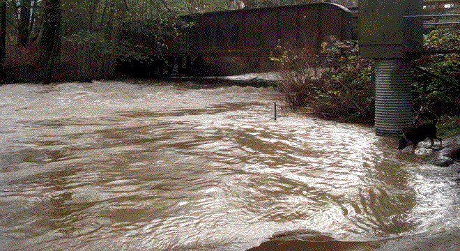
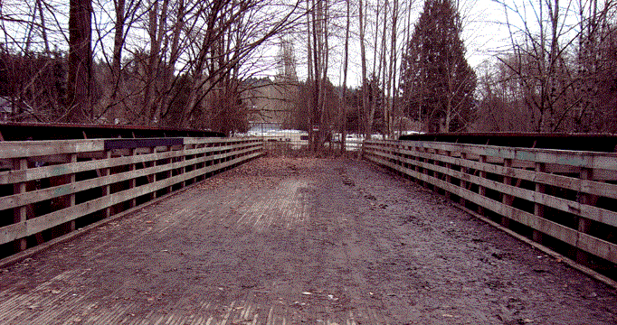
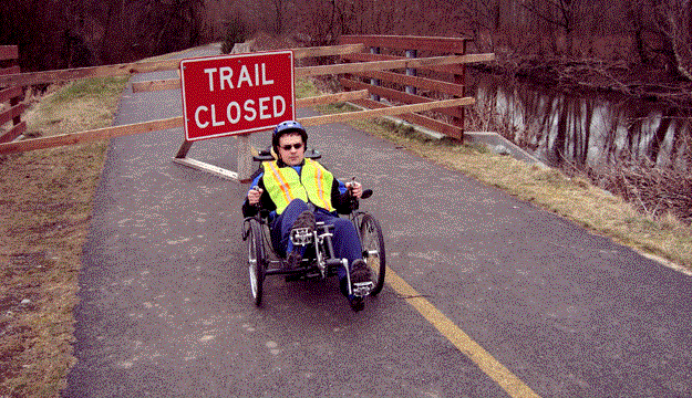
The east end of the Foothills Trail starts at Veterans' Park, beside the fire station in South Prairie. The terminus is a bridge to nowhere (below), awaiting extension of the trail to Wilkeson and Carbonado. South Prairie Creek flows under the bridge and then meanders through the valley, rejoining the trail a few miles downstream.

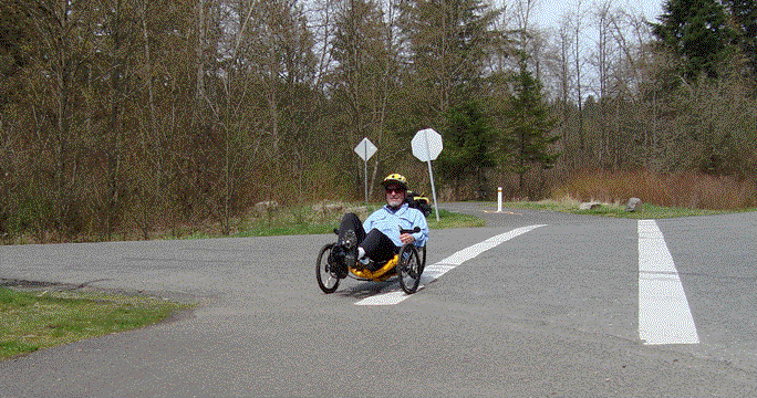
There is a parking lot at the trailhead, with restrooms and information. It is located a few hundred feet from the park at the trail end.

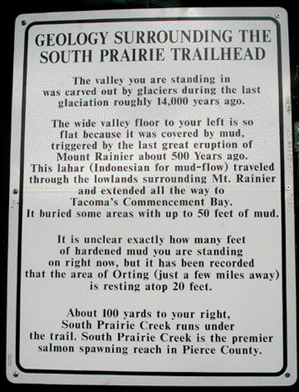
The Foothills Trail has several unique features. It is one of the few bike trails that provides a warning that you might get buried under 50 feet of mud.

Even though the mudflow will come sooner or later, local officials did approve lowland development for thousands of houses and an elementary school.

The trail is also unique in that it crosses two rivers, each named for the glacier that is its source. ((Mt. Rainier has 28 active glaciers.) The last big eruption of the mountain was 500 years ago, but smaller eruptions occurred in the 1800s. Steam continues to rise from vents at the summit.

First stop at the South Prairie end of the trail is an espresso stand.

Only in Washington would you see a giant cup of coffee made from a giant cedar log.

South Prairie, population 432, has two espresson stands on the trail.

The small town contains several unusual houses, including this double, where two houses were remodeled into one.

At the edge of town, we meet one of the few recumbent trail users.

A few months later, we discovered it was Mark Calkins, riding his Bacchetta Giro 20

Another mystery recumbent rider.

Three wheels squared is around nine.

Leaving the trailhead, we head through town, past some fields, and into the forest. The present trail is flat for its entire length, so it is easy ride.

Most people were supportive of building the trail, but one farmer resisted for many years. He hung a bicycle and stuffed rider from a noose in his yard to express his opinion. (It is gone now.)

About a mile out of town, the trail catches up again with South Prairie Creek. The smooth pavement and very slight downhill make for fast riding.

Jim Aliano ventures outside the lines.

A portion of the trail periodically closes for flood repairs, but a short alternate route on a back road has little traffic.

Coming back is a little slower, but the climb doesn't slow Jordan down.

Coming out of the forest, we ride across the fields back into the town of South Prairie.