The area known as Haida Gwaii, the Queen Charlotte Islands or simply “the Charlottes,” consists of a tight cluster of islands lying 50 to 150 kilometres off the northwestern coast of British Columbia. For millennia, it has been a remote, mysterious and inaccessible place, but developments during the last four decades have raised the profile of this unique and beautiful region.
Haida Gwaii has always been a distinctive place, and the first people to settle here developed an exceptional cultural identity. Long before European contact, the Haida were revered and feared, from what is now Alaska south to Washington State and beyond.
Haida Gwaii offers unparalleled opportunities for diverse interests across its culturally and ecologically rich landscapes.
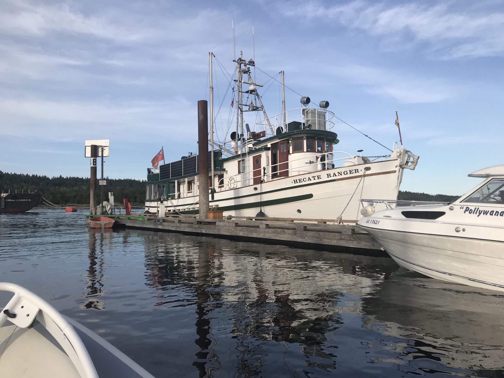
Built in 1962 for the British Columbia (BC) Forest Service to be part of their Hecate Strait survey and patrol fleet, the 66 foot Hecate Ranger was rebuilt in Port Townsend in 2017. It was great to see her at Ladysmith.
Below is a breakdown of key attractions and logistics:
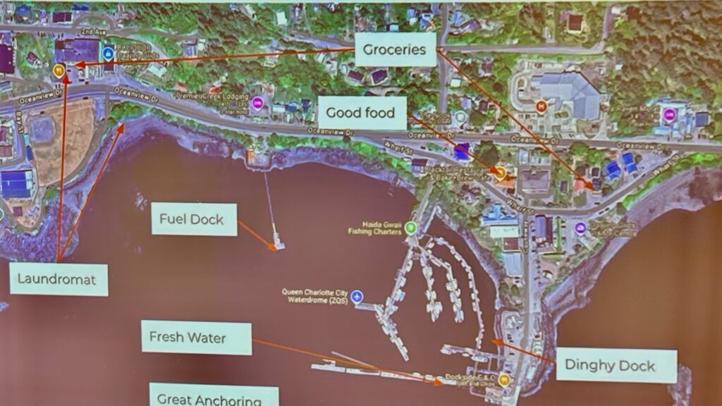
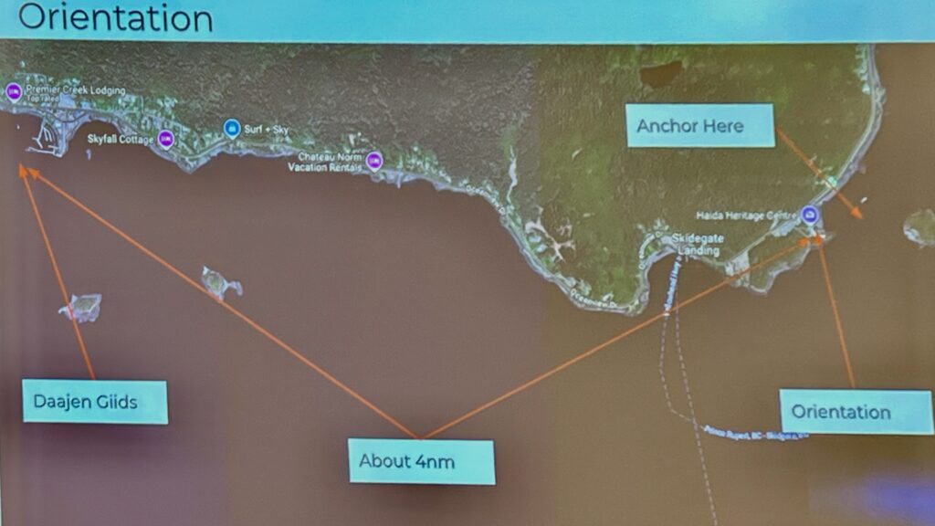
Daajing Giids (Formerly Queen Charlotte City)
Daajing Giids (pronounced DAW-jing GEEDS; formerly Queen Charlotte) – located on the southern end of Graham Island. This village offers several motels, shops, restaurants, a gas station and auto repair, a credit union, RCMP station and a hospital. It is also the location of the Daajing Giids Visitor Centre. With its small harbour, Daajing Giids is often the starting-point for chartered tours into Gwaii Haanas National Park Reserve and Haida Heritage Site.
Boater: Small harbor serving as a launch point for Gwaii Haanas tours1.
Birder: Skidegate Inlet’s intertidal zones for shorebirds and seabirds5.
Anthropologist/Historian: Study the town’s 1891 founding, 2022 ancestral name restoration, and Haida Gwaii’s colonial/postcolonial history1.
Geologist: Examine glacial deposits and marine terraces around Graham Island5.
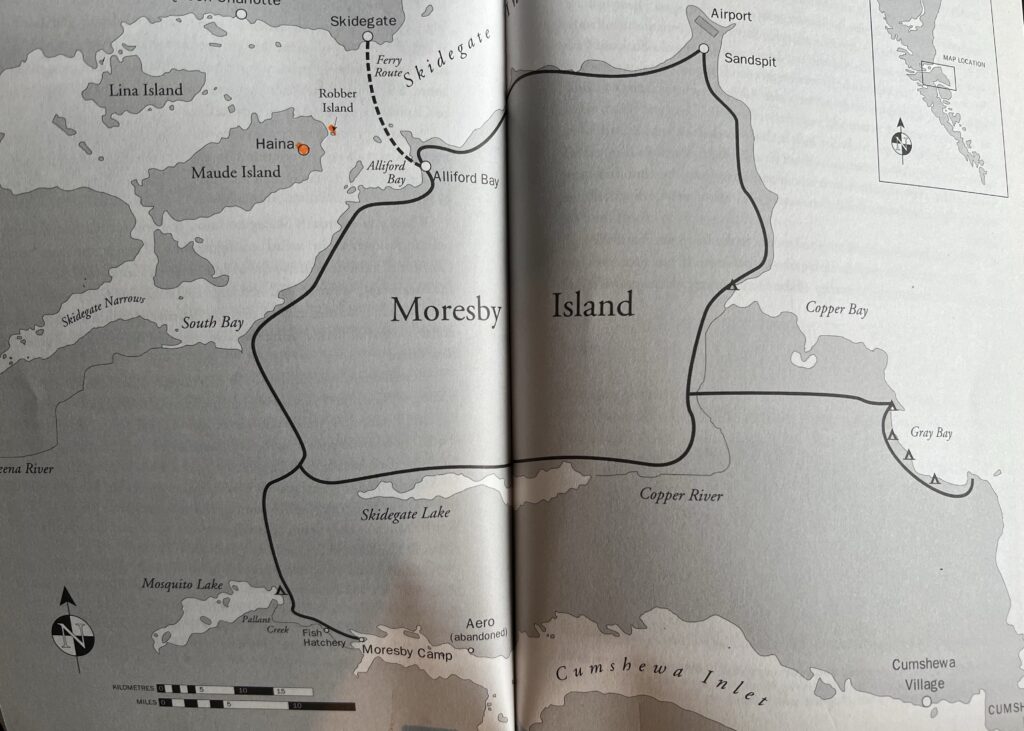
Chartered boat tours into Gwaii Haanas National Park Reserve start at Moresby Camp. There are no trails or roads to the park which is 60 km from Moresby Camp.
Gwaii Haanas National Park Reserve
Boater: Navigate wildlife-rich waters for whale watching (humphacks, orcas) and island exploration24.
Birder: Bald eagle nesting sites and migratory seabird colonies2.
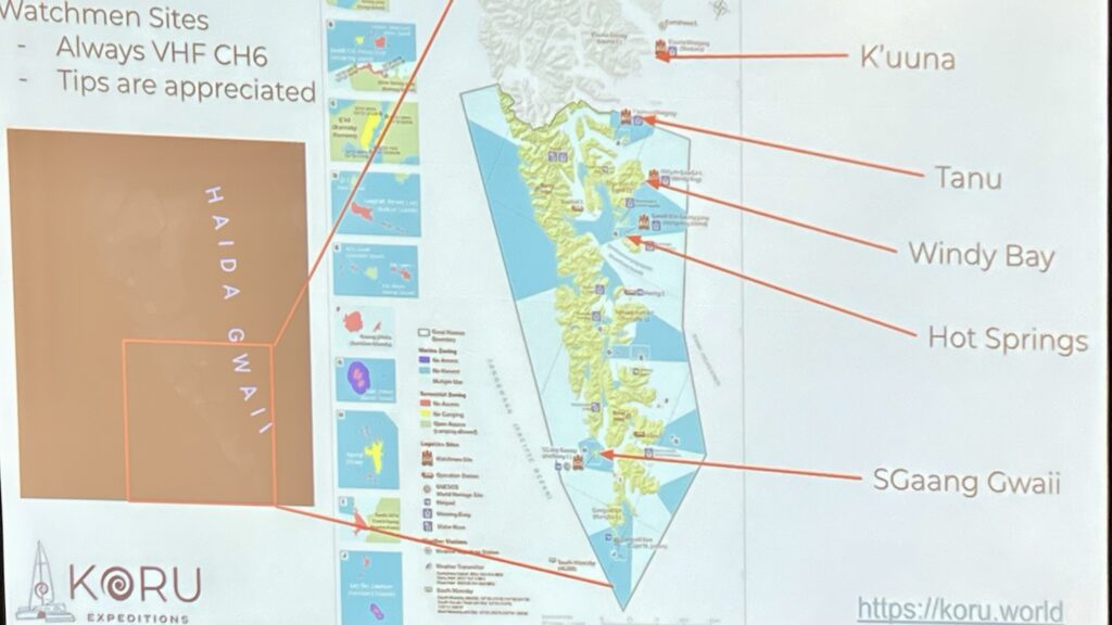
Anthropologist: Interact with Haida Watchmen at village sites like SG̱ang Gwaay and analyze cooperative Indigenous-government management24.
Biologist: Study old-growth rainforest ecosystems and marine biodiversity, including sea lions and porpoises25.
Historian: Explore the park’s role in Haida land stewardship and the 1993 Gwaii Haanas Agreement28.
Admission: Mandatory orientation session and daily fee ($24.50 CAD)2.
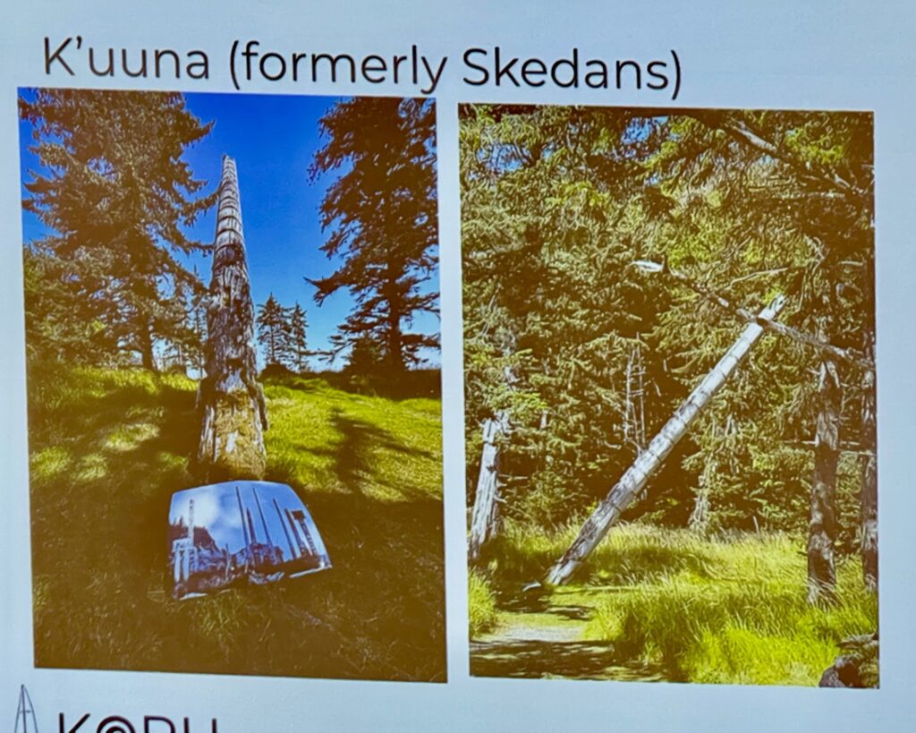
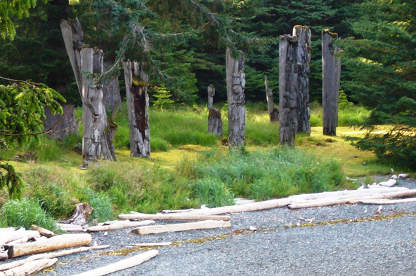
K’uuna Llnagaay (Skedans)
Anthropologist/Historian: Examine 19th-century mortuary poles and longhouse depressions at this former Haida village3.
Geologist: Observe Louise Island’s volcanic bedrock formations5.
Birder: Forest trails for spotting endemic subspecies like the Haida Gwaii saw-whet owl5.
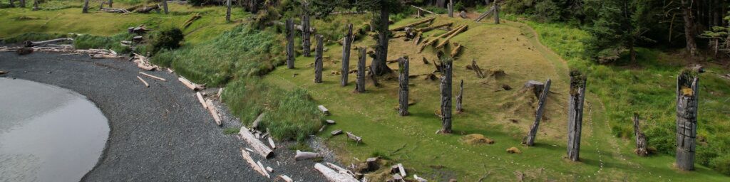
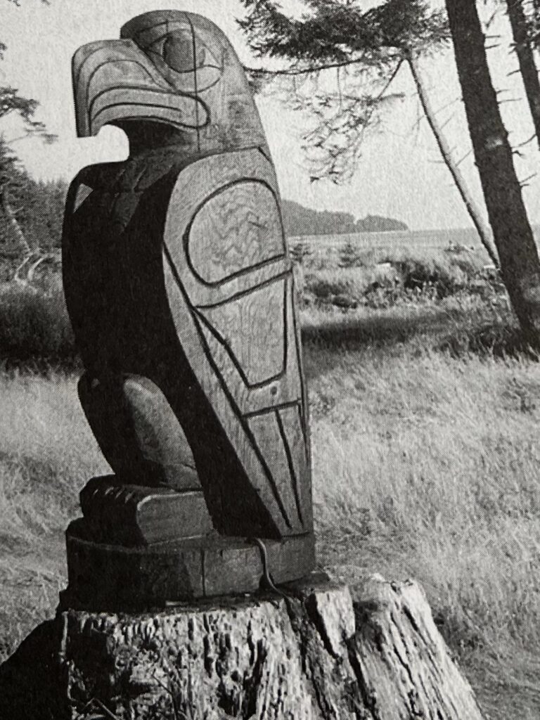
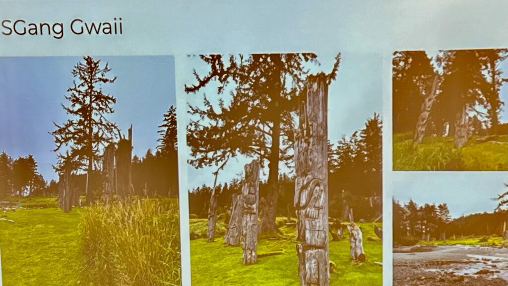
SG̱ang Gwaay (UNESCO World Heritage Site)
Anthropologist/Historian: Study 18th-century standing poles and longhouse beams at Nan Sdins village, a pinnacle of Haida monumental art4.
Biologist: Research intertidal zones and endemic flora in this protected area5.
Boater: Anchor outside the bay (no vessels permitted in front of the village)4.
SG̱ang Gwaay (Anthony Island) is located in the exposed southwest corner of Gwaii Haanas. The Haida name means Wailing Island, based on a sound created at certain tides when air is pushed through a hole in a rock on the island. This sound is thought to resemble the keening of a woman. SG̱ang Gwaay consists of a larger island and 27 small islets.
The village, SG̱ang Gwaay Llnagaay (Nan Sdins), is a UNESCO World Heritage Site and is located in a sheltered bay on the east side of the island. Visitors can explore upright and fallen poles, house pits, and standing posts and beams of longhouses.
Boats and kayaks are not permitted in the bay in front of the village. This preserves the experience for visitors who are already in the village site.
Skidegate
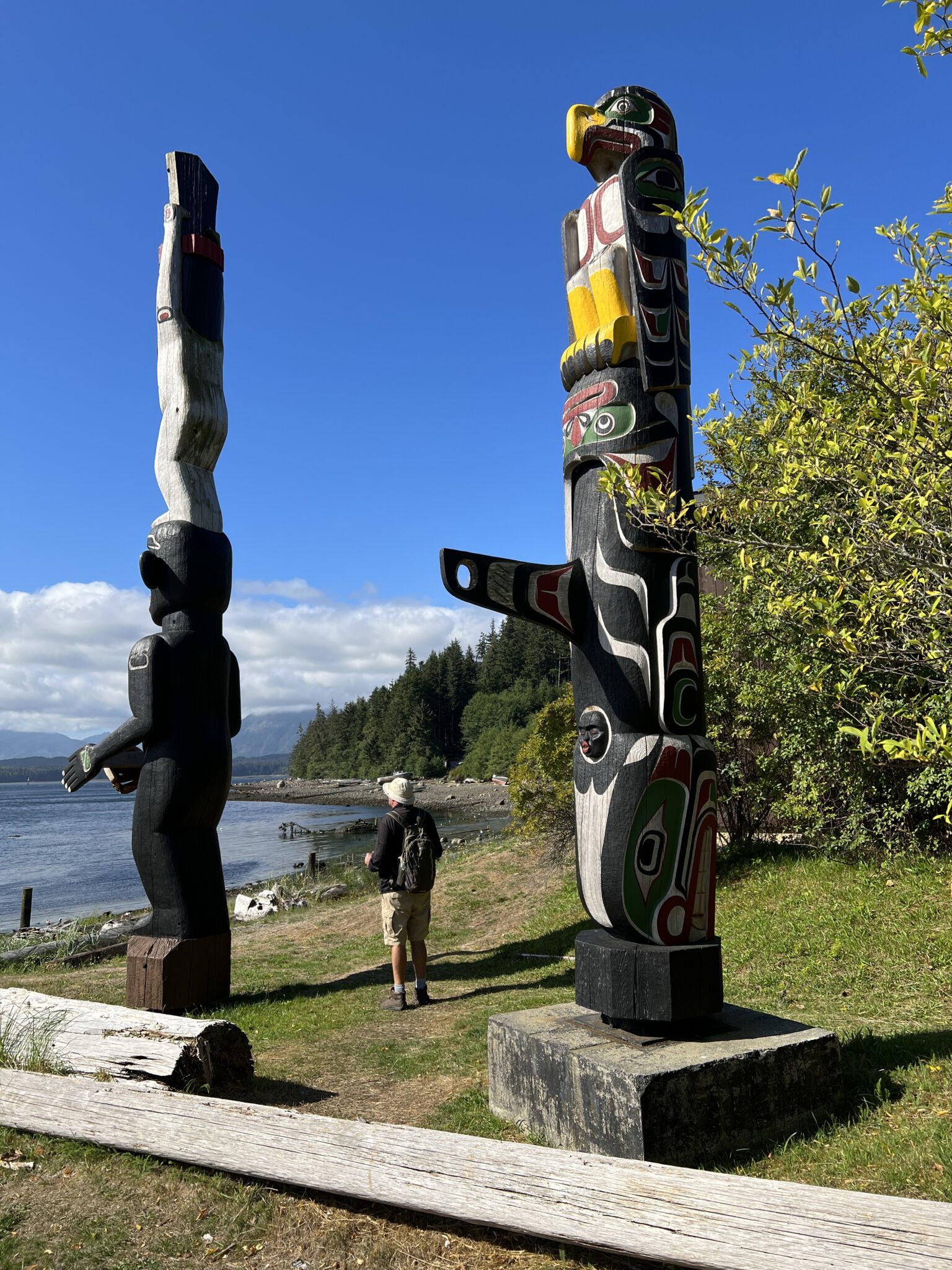
Skidegate – located on the southeast end of Graham Island. It is a Haida community located on Skidegate Indian Reserve No. 1. The ferry terminal is located here. Skidegate is home to a number of totem poles as well as the Haida Heritage Centre.
Boater/Transport: BC Ferries terminal connecting Graham and Moresby Islands17.
Historian: Visit the Haida Heritage Centre for totem poles and canoe exhibits1.
Other Key Sites
Rose Spit (Hiellen): Ecological reserve with rare dune flora for biologists5.
Tow Hill: Basalt formations for geologists and hiking trails for birders5.
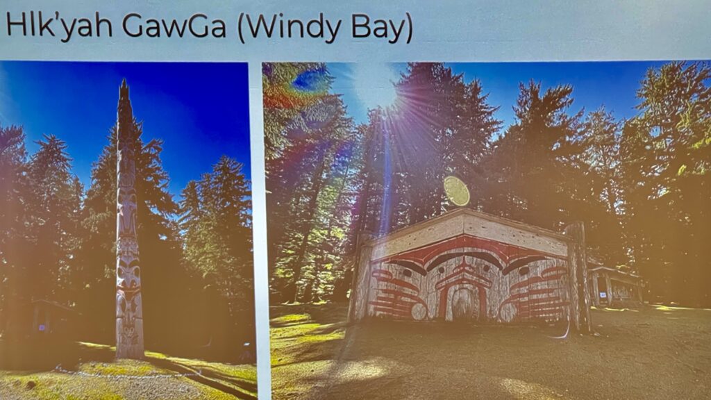
Windy Bay
Not always accessible on trips due to its southeast exposure, this former village site features an incredible forest walk with 900-year-old Sitka trees and a watershed that, at the right time of year, sees adult salmon spawning in the creek. This watershed was the epicenter of the 1980s protests to save the old-growth forests to the south.
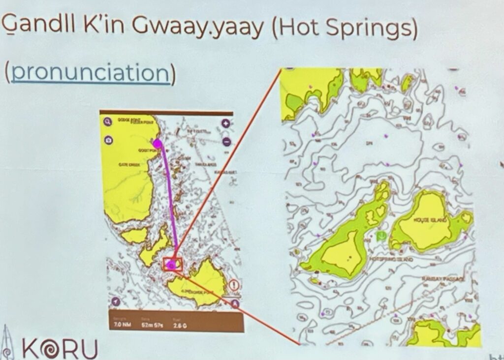
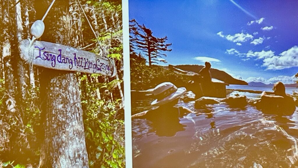
Perhaps the lap of luxury, this place has a wow factor of a gazillion! The absolute mystery of the freshwater, the perfect view, the amazing temperature, and the wonder of sitting along a fault line that has shaped this area make it a dreamy experience. The trail to the hot springs is also magical, and sometimes the trees on the route host a bounty of chicken of the woods, a delicious mushroom that can be cooked in butter and garlic to pair with any meal. The impermanence of the hot springs adds to its appeal, after a 7.8 magnitude earthquake blocked the hot spring in 2012, lasting until 2015.
Ibid
Logistics
Car Rentals:
Masset Car and Truck Rental (serves Masset Airport and Haida Gwaii)6.
Water Taxis:
BC Ferries operates passenger-only taxis between Alliford Bay and Skidegate during M.V. Kwuna retrofits (check seasonal schedules)7. Skidegate is located on the southeast end of Graham Island. It is a Haida community located on Skidegate Indian Reserve No. 1. The ferry terminal is located here. Skidegate is home to a number of totem poles as well as the Haida Heritage Centre.
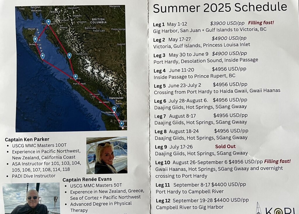
What kind of vessel can make it? – Koru Expeditions saw as small as 27’…as large as 180’
Equipment VHF Reliable communications BEYOND VHF (Iridium Go, SSB, Starlink, etc) Reliable Radar and AIS Power Generation (Solar/generator) Paper Charts
Tankage Enough fuel capacity to 350 miles Enough water for 7-10 days (about 5 gallons per person per day)
Rules to Follow
Orientation: Mandatory for Gwaii Haanas visitors (covers cultural respect, safety)28.
Cultural Protocols:
Do not touch or remove artifacts at heritage sites48.
Pack out all waste; no foraging or disturbing wildlife28.
Use bear-resistant containers for food in Gwaii Haanas2.
This archipelago rewards visitors with a blend of natural wonder and living Indigenous culture, requiring mindful exploration to preserve its integrity.
The best time to visit Daajing Giids depends on priorities like weather, wildlife, and crowd preferences:
May
Weather: Cool (5–12°C / 41–54°F) with misty conditions6.
Highlights:
Peak birding season (eagles, hummingbirds, migratory seabirds)6.
Considerations: Many services close by mid-month15.
General Advice
Booking: Reserve tours (especially Gwaii Haanas) and lodging 6+ months in advance25.
Packing: Waterproof layers, insulated jackets, and sturdy footwear year-round16.
Wildlife: Orcas are year-round; humpbacks February–fall; gray whales March–June5.
For a balance of mild weather and manageable crowds, May or late June are ideal. Prioritize July–August for guaranteed tour availability and warmest conditions156.
The Edge of the World Music Festival (EOTW) will take place August 8–10, 2025, at the Tlell Fall Fairgrounds on Haida Gwaii234.
Location Details
Venue: Situated in Naikoon Provincial Park, near the Tlell River on Graham Island4.
Access:
Fly from Vancouver via Air Canada or Pacific Coastal Airlines.
Music: Features local and international artists across genres14.
Activities: Workshops, artisan vendors, and local cuisine13.
Rules: Family-friendly; alcohol and drugs prohibited3.
Visitors are encouraged to sign the Haida Gwaii Pledge before arrival to respect Indigenous lands and cultural protocols34.
Here’s a detailed car trip plan to the Edge of the World Music Festival (EOTW) in Tlell, Haida Gwaii, including a day visit to SG̱ang Gwaay by floatplane:
Trip Plan
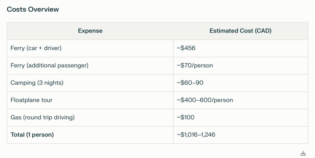
Day 1: Prince Rupert to Tlell
Ferry from Prince Rupert to Skidegate (Graham Island):
Cost: ~$456 CAD for a car and driver (round trip), ~$70 CAD per additional passenger.
Duration: ~8.75 hours.
Booking: Reserve via BC Ferries well in advance.
Drive to Tlell:
Distance: ~45 minutes from Skidegate ferry terminal via Highway 16.
Camping at Misty Meadows Campground:
Cost: ~$20–30 CAD per night (first-come, first-served).
Located across from the festival grounds.
Day 2: Floatplane Tour to SG̱ang Gwaay
Floatplane Departure from Masset Airport:
Drive ~2 hours from Tlell to Masset via Highway 16.
Haida Tourism SG̱ang Gwaay Tour:
Includes round-trip floatplane airfare, Zodiac transfer, guided interpretive tour with Haida Watchmen, park entrance fees, and lunch.
Cost: ~$400–600 CAD per person.
Booking: Reserve through Haida Tourism; minimum of four passengers required.
Return to Tlell:
After the tour, drive back to your campsite near the festival grounds.
Day 3: Edge of the World Music Festival
Enjoy live music and cultural activities at the Tlell Fall Fairgrounds.
Explore nearby attractions like the Tlell River or Naikoon Provincial Park.
Complete the mandatory Parks Canada orientation (included in Haida Tourism’s package).
Book directly with Haida Tourism for the floatplane tour; spots are limited, so reserve early.
This plan combines music, culture, and adventure while ensuring a seamless visit to one of Haida Gwaii’s most iconic sites!
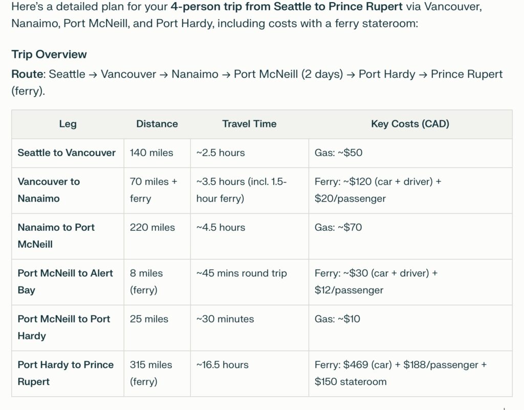
Seattle to Prince Rupert
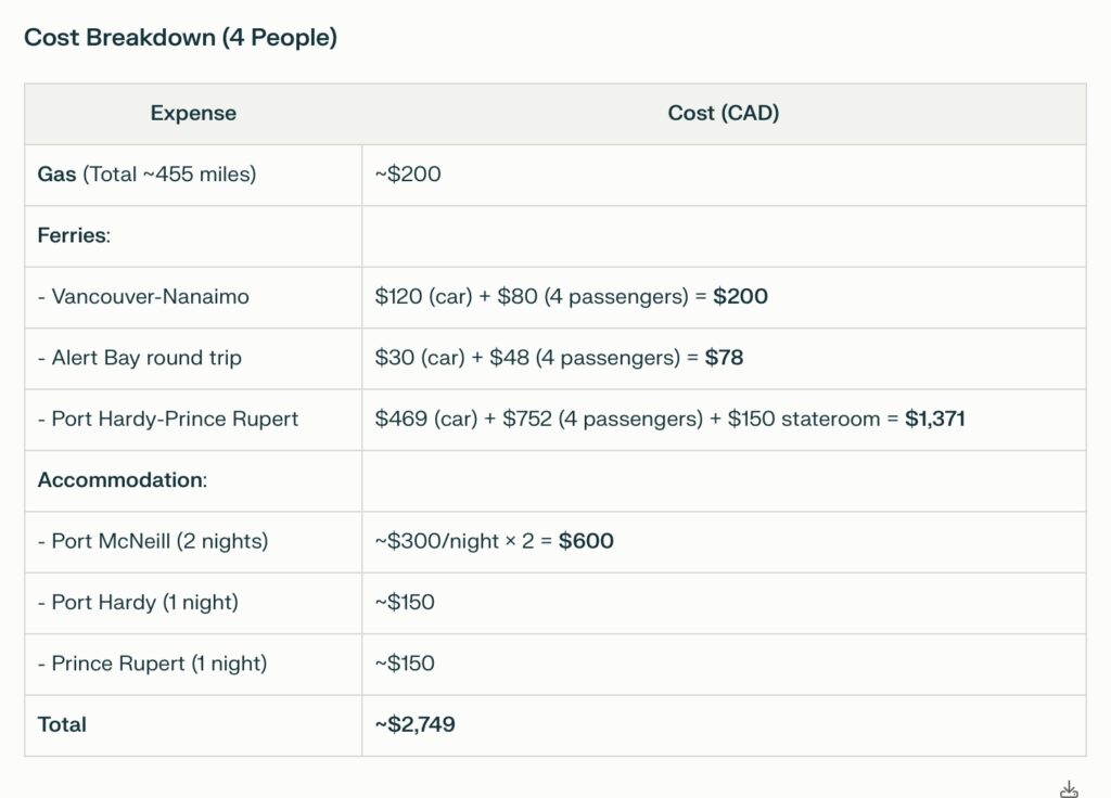
Here’s a detailed plan for your 4-person trip from Seattle to Prince Rupert via Vancouver, Nanaimo, Port McNeill, and Port Hardy, including costs with a ferry stateroom:
Trip Overview
Route: Seattle → Vancouver → Nanaimo → Port McNeill (2 days) → Port Hardy → Prince Rupert (ferry).LegDistanceTravel TimeKey Costs (CAD)Seattle to Vancouver140 miles~2.5 hoursGas: ~$50Vancouver to Nanaimo70 miles + ferry~3.5 hours (incl. 1.5-hour ferry)Ferry: ~$120 (car + driver) + $20/passengerNanaimo to Port McNeill220 miles~4.5 hoursGas: ~$70Port McNeill to Alert Bay8 miles (ferry)~45 mins round tripFerry: ~$30 (car + driver) + $12/passengerPort McNeill to Port Hardy25 miles~30 minutesGas: ~$10Port Hardy to Prince Rupert315 miles (ferry)~16.5 hoursFerry: $469 (car) + $188/passenger + $150 stateroom
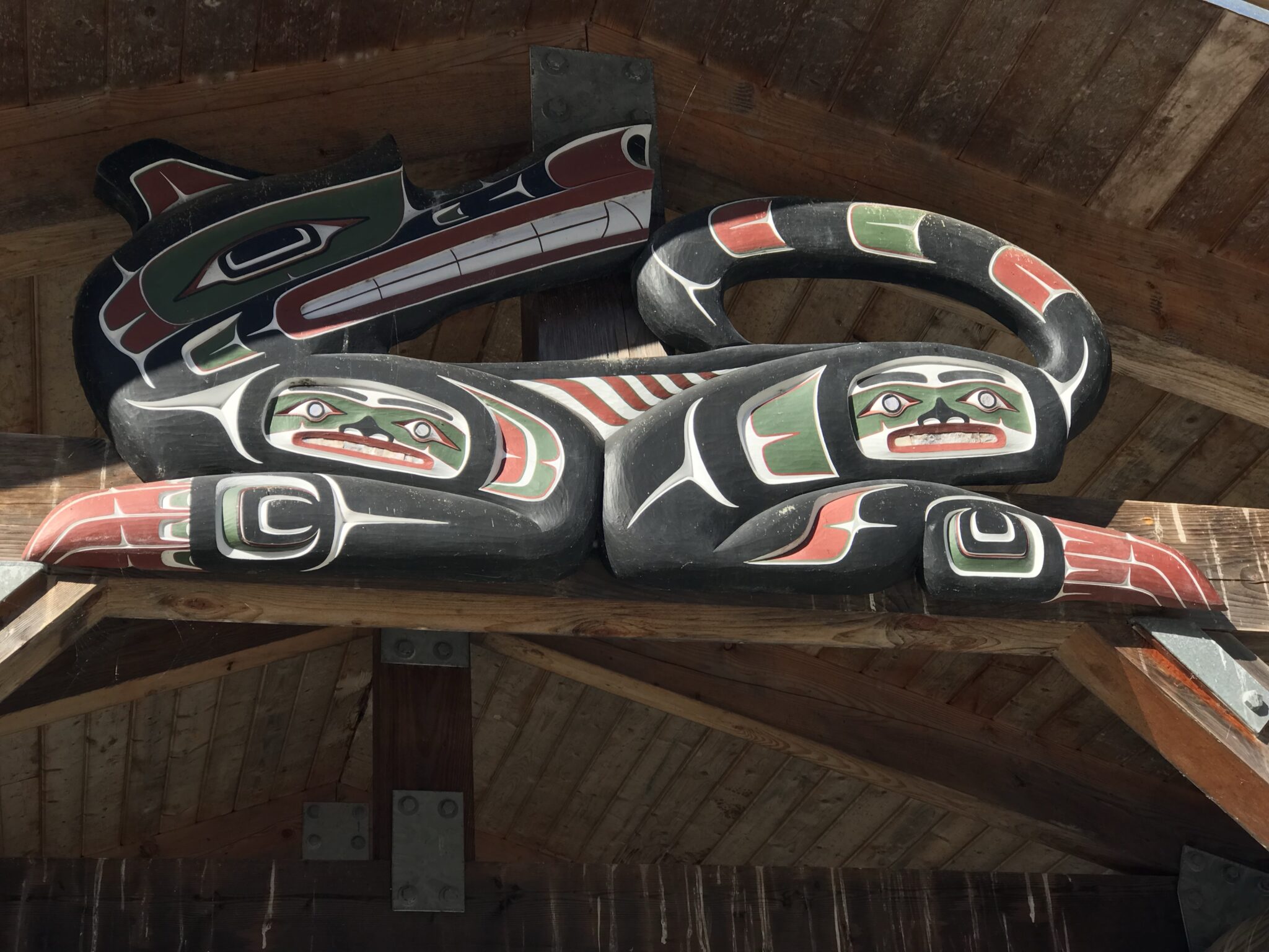
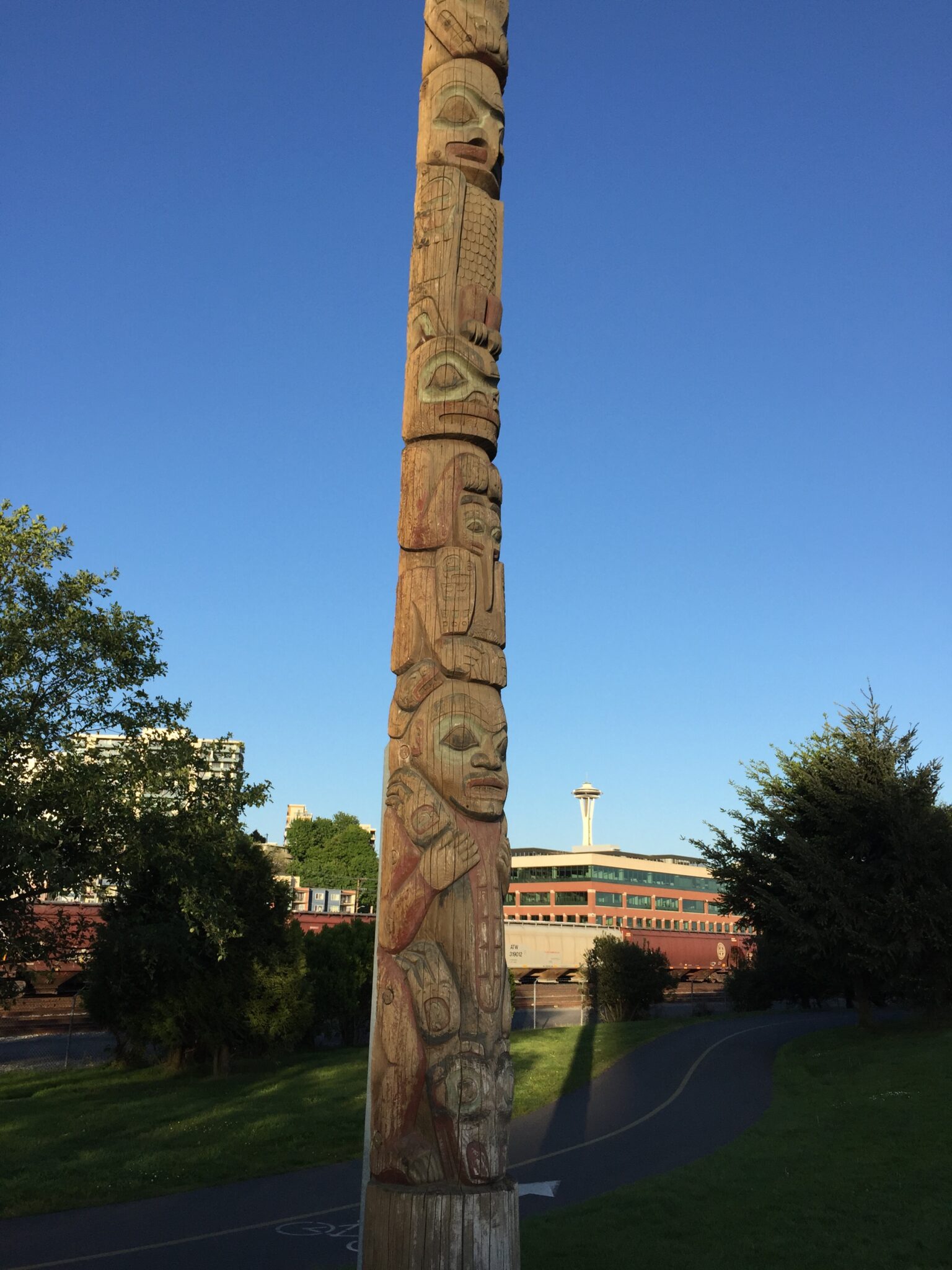
EAGLE represents a main clan of the Tlingit tribe. BROWN BEAR denotes the great size of Alaska, holding a TINNAH or money piece as a symbol of the great wealth of the great land. KILLER WHALE portrays tenacity and great strength. HAWK depicts sharp eyesight and perception of our future. GRIZZLY BEAR typifies bravery, but holds a MOSQUITO to warn people all is not easy. STRONG BOY was ridiculed by all as being a dolt and for being lazy. Strong Boy exercised in secret and when his uncle was swallowed by a SEA LION, all the other nephews ran. Strong Boy seized the Sea Lion by the tail and tore it in half, letting his uncle out alive.
Key Details
Vancouver-Nanaimo Ferry:
Depart from Tsawwassen Terminal to Duke Point (reserve via BC Ferries).
Alert Bay Visit:
Ferry from Port McNeill to Cormorant Island (Alert Bay) runs hourly; book day-of.
Port Hardy-Prince Rupert Ferry:
Mandatory stateroom/berth reservations; book 6+ months ahead for summer travel.
Logo of University of Washington School of Public Health and Community Medicine
Tips
Documents: Ensure passports/Enhanced Driver’s Licenses for border crossing.
Food: Bring snacks for ferries; onboard meals are limited.
Wildlife: Watch for whales and eagles during ferry rides!
Enjoy this mix of coastal drives, Indigenous culture, and wilderness!