What are the Channel Islands off California? Which ones are part of a National Park? What is noteworthy?
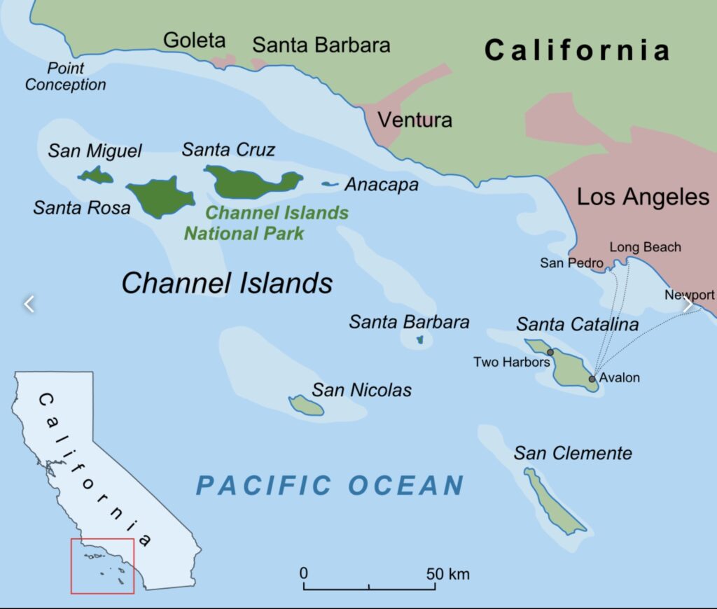
The Channel Islands are an eight-island archipelago located within the Southern California Bight in the Pacific Ocean, off the coast of California. A bight is a bend or curve in the shore of a sea or river, forming an open bay17. The four Northern Channel Islands are part of the Transverse Ranges geologic province, and the four Southern Channel Islands are part of the Peninsular Ranges province1.
The Northern Channel Islands experience colder, oxygen-rich water flowing in from the north, while the Southern Channel Islands have warmer, oxygen-poor water flowing in from the south10.The Northern Channel Islands span the transition between the cooler Oregonian Province and the warmer Californian Province, resulting in high species diversity and substantial differences in species composition over short distances10.
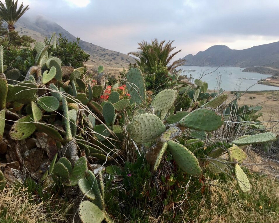
The Northern Channel Islands are home to a unique suite of plants and animals that have adapted to the particular conditions of each island, with many species and subspecies not found anywhere else1.
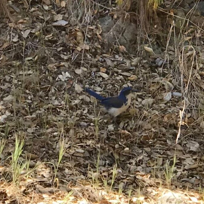
distinctve plant and animal species nave adapted to the island’s unique environment, including the island scrub-jay.
The Southern Channel Islands also have a diverse range of species, but the specific species composition may vary from the Northern Channel Islands due to differences in climate and ocean currents3.
The Northern Channel Islands have a rich history of native Chumash communities who inhabited the islands for thousands of years1.
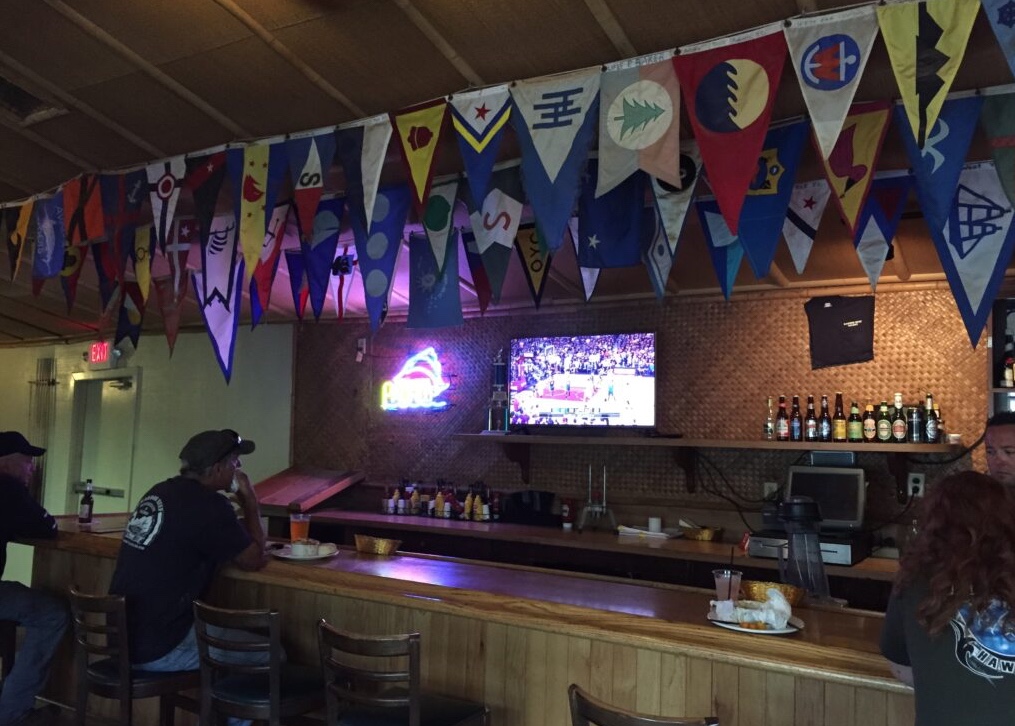
The Southern Channel Islands, such as Santa Catalina Island, have a different history, with commercial development and a resident population of approximately 4,000 people3. Santa Catalina Island is the only Channel Island with commercial development and receives about 1 million visitors each year3.
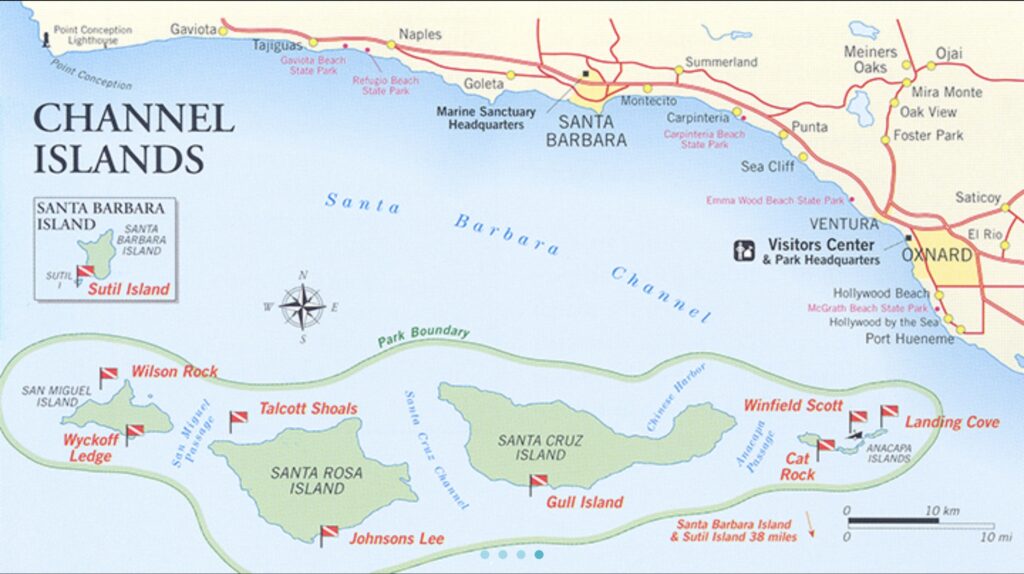
The Northern Channel Islands include:
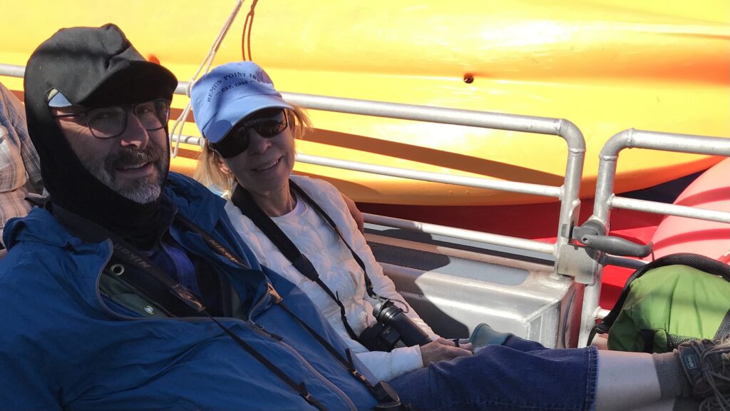
- San Miguel Island: Sea kayaking at San Miguel Island is recommended only for highly experienced, skilled, and conditioned kayakers with all necessary safety equipment due to the consistently extreme weather and sea conditions2. There are no specific guidelines for anchoring off San Miguel Island, but it is recommended to stay clear of the pier and mooring field, which are for official use only1.
- Santa Rosa Island: Sea kayaking at Santa Rosa Island is recommended only for highly experienced, skilled, and conditioned kayakers with all necessary safety equipment due to the consistently extreme weather and sea conditions2. Anchoring is not recommended, and there are no designated areas for anchoring off Santa Rosa Island1.
- Santa Cruz Island You can anchor at Prisoners Harbor, which is a popular anchorage for boaters3. Anchoring is not allowed in Scorpion Anchorage, and the pier and mooring field are for official use only4. You can anchor at Little Scorpion Anchorage, but it is deep and can be challenging for bow and stern anchoring4.
- Anacapa Island10 The landing dock is available for unloading purposes only, and no craft, including kayaks and inflatables, should be left moored to the dock4. There are no specific guidelines for anchoring off Anacapa Island, but it is recommended to stay clear of the pier and mooring field, which are for official use only1.
The Southern Channel Islands include:
- San Nicolas Island: This is the island made famous by the book called “Island of the Blue Dolphin” by Scott O’Dell1. The book is based on the true story of Juana Maria, a Nicoleño Native American left alone for 18 years on San Nicolas Island during the 19th century1. San Nicolas Island is used for missile testing, classified operations training, and as a sea range for developmental and operational test and evaluation15.
- Santa Barbara Island: There are no specific guidelines for anchoring off Santa Barbara Island, but it is recommended to stay clear of the pier and mooring field, which are for official use only1.
- Santa Catalina Island: You can anchor at various locations around Catalina Island, such as Two Harbors and Avalon. Mooring and docking rules apply, and you should not create a navigational hazard or interfere with other vessel use6. You may need a mooring permit, and there are specific rules and regulations for mooring and docking in these areas5.
- San Clemente Island10 is primarily used for training purposes, including air-to-air, air-to-ground, and surface-to-air weapons testing2.During World War II, San Clemente Island served as a training base for amphibious operations, and in the Vietnam War, it was used as a training area for riverine forces2
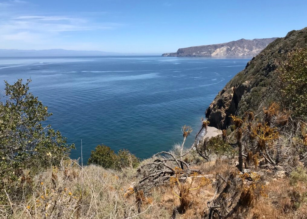
Five of these islands (San Miguel, Santa Rosa, Santa Cruz, Anacapa, and Santa Barbara) were made into the Channel Islands National Park in 19801. The park covers 249,561 acres, of which 79,019 acres are federal land8. The Channel Islands National Marine Sanctuary encompasses the waters six nautical miles off these islands18.
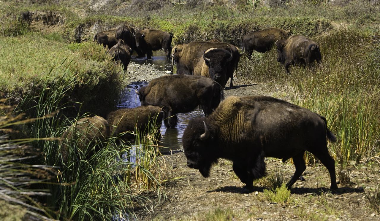
The Channel Islands are often referred to as the “North American Galapagos” due to their unique biodiversity. They are home to a unique suite of plants and animals that have adapted to the particular conditions of each island. Many of these species and subspecies are not found anywhere else35. For example, the islands are home to the endemic island fox, which is not found anywhere else in the world6.
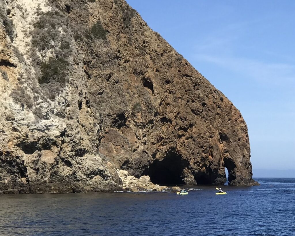
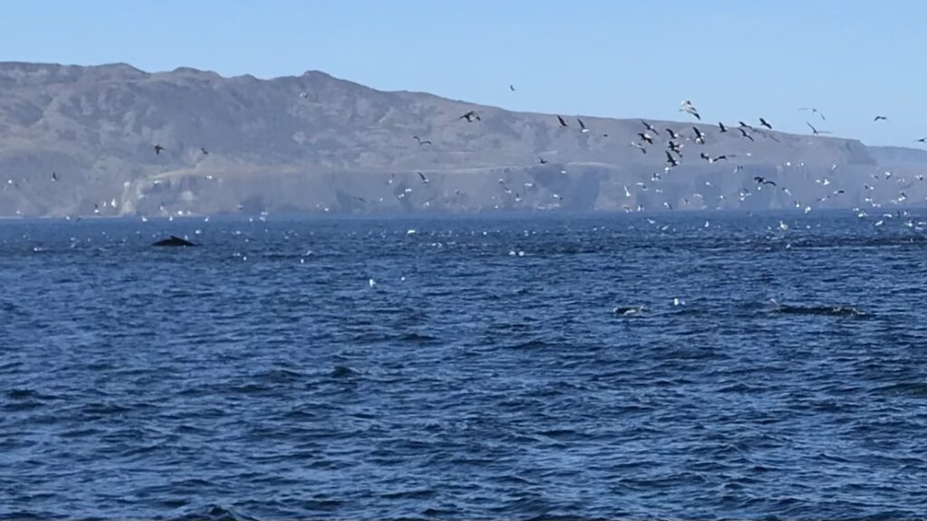
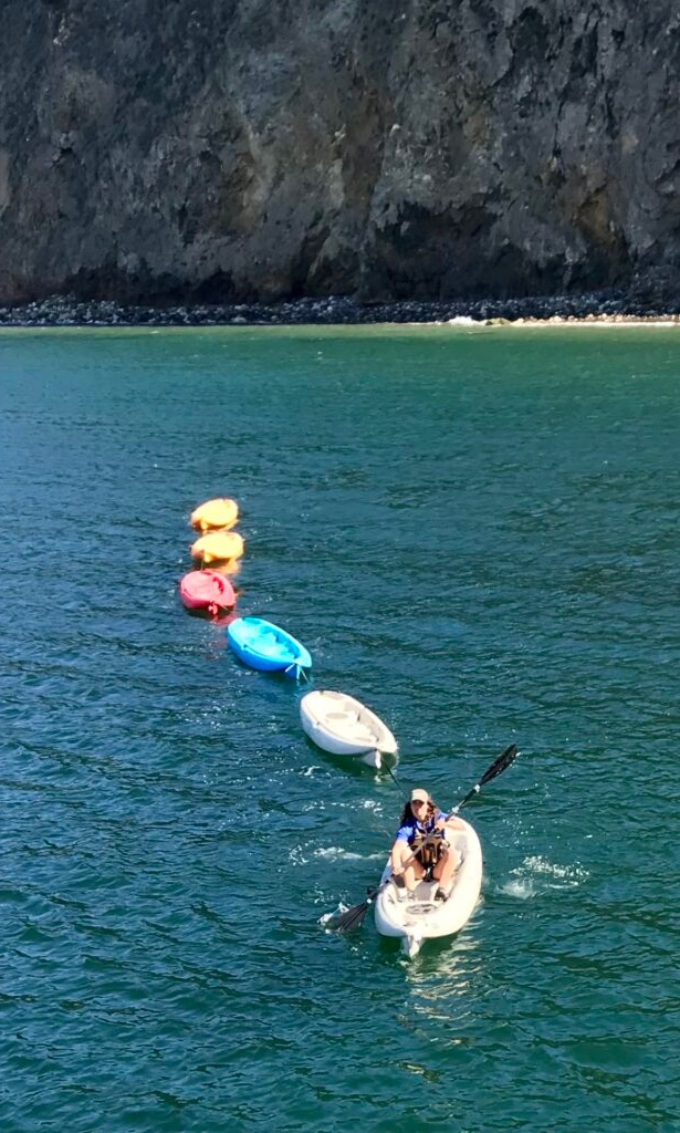
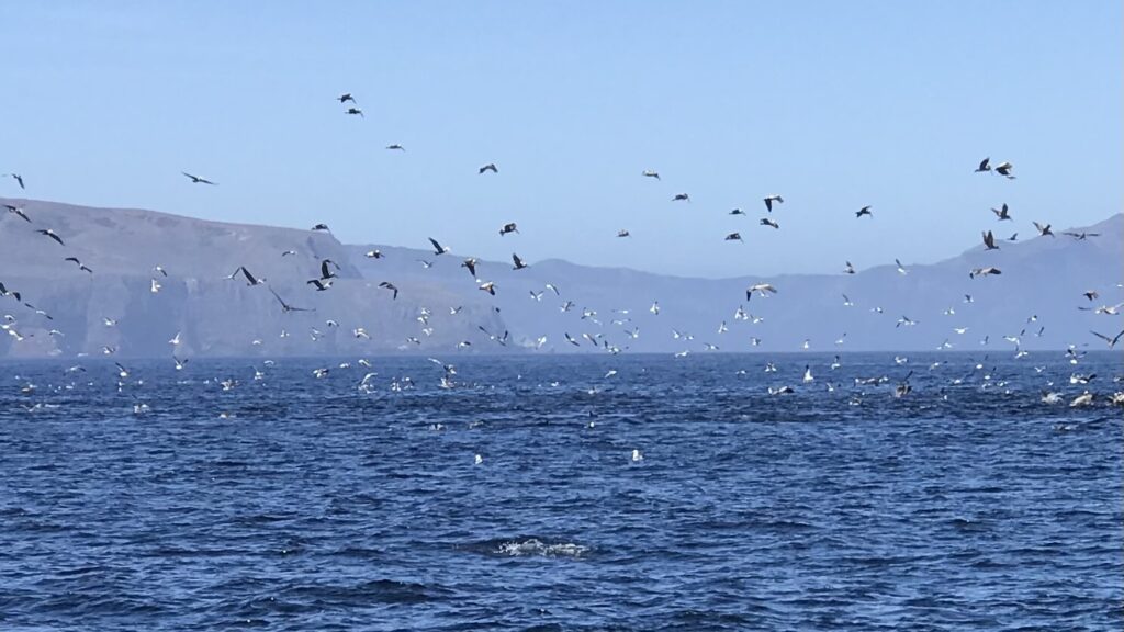
The park is renowned for its large number of complex, beautiful sea caves, and kayaking through these caves is a popular activity8. The islands also offer opportunities for hiking, camping, and scuba diving8. The waters around the islands are exceptionally productive, with cool, nutrient-rich ocean currents supporting a diverse range of sea life, from microscopic plankton to blue whales3.
The Channel Islands also have a rich cultural history. They preserve many archaeological sites and artifacts, and the islands remain central to the Chumash creation story5.
Despite their proximity to the densely populated state of California, the islands have remained relatively undeveloped, offering visitors a chance to experience coastal southern California as it once was48.
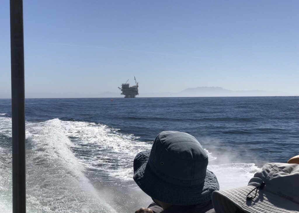
Oil is currently pumped from platforms in the Santa Barbara Channel, which is located in close proximity to the Channel Islands National Park. The Santa Barbara Channel has a long history of oil drilling, with the region being an attractive resource for the petroleum industry for over a hundred years1. The first offshore oil drilling in the world took place in the southern coast of Santa Barbara County, just 6 miles from the site of the 1969 Santa Barbara oil spill1.
The Santa Barbara Channel is known for its natural hydrocarbon seeps, with the Coal Oil Point seep estimated to discharge approximately 150-170 barrels (6,300-7,140 gallons) of oil per day5. The region’s oil drilling activities have raised concerns about the potential impact on the environment, including the Channel Islands National Park, which experienced oil pollution during the 1969 spill3.
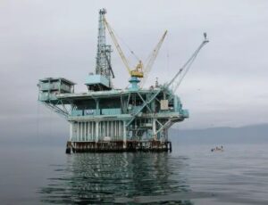
Platform A in 2006
Platform A was positioned in 188 feet (57 m) of water, 5.8 miles (9 km) from the shore at Summerland. It had 57 slots for wells from which it could drill directionally into the oil reservoir from different angles.[18] At the time of the spill, it was one of twelve platforms already in the waters off California.
Efforts have been made to address the environmental risks associated with oil drilling in the Santa Barbara Channel. In 2023, a drilling site on the Channel Islands was deemed a safety hazard, and plans were made to cap an old oil well on Santa Cruz Island, which is part of the Channel Islands National Park2. However, the presence of active oil platforms in the Santa Barbara Channel continues to be a concern for the park and its surrounding marine ecosystem.
The history of oil drilling in the Santa Barbara Channel is as follows:
- The Santa Barbara Channel was home to the first offshore oil well in Summerland in 18965.
- The first platform, Hazel, was erected in the Channel in 1958, two miles offshore of Summerland5.
- In 1969, an environmental disaster occurred in the Santa Barbara Channel when an offshore oil platform, Platform A, suffered a blowout. This resulted in 200,000 gallons of crude oil escaping into the ocean over a period of eleven days, creating an 800-square-mile slick that impacted all of the northern Channel Islands and nearby mainland beaches1. This event is considered a major impetus to the environmental movement in the United States4.
- The Santa Barbara oil spill led to the creation of one of the first environmental studies departments in the country at the University of California, Santa Barbara (UCSB)4.
- The spill also resulted in the passage of the National Environmental Policy Act in 1970 and the Clean Water Act in 19724.
Protests against oil drilling in the Santa Barbara Channel have been ongoing since the 1969 oil spill. In recent years, there have been discussions about the decommissioning of several platforms in the area, and environmental organizations like the Santa Barbara Channelkeeper have been involved in reviewing and commenting on Environmental Impact Reports and other associated documents5.
The history of the Channel Islands National Park is rich and spans thousands of years. The northern Channel Islands were home to many native Chumash communities who are believed to have inhabited the islands for thousands of years. See below for more on the
The Chumash Creation Myth
One day to amuse himself, Eagle took some clay from Mother Earth and fashioned it into men and women, whom he gave life and sent out in pairs to populate the earth. Some say that he ground up magic seeds and mixed them with the clay. The ones that he sent to the eastern mountains spoke their own language and later became the ancestors of the Kawaiisu and the Tubatulabal, those that he sent to the western mountains and the Channel Islands spoke a different language and later became the ancestors of the Chumash, and those that stayed spoke yet a third language and later became the ancestors of the Yokuts.

When Europeans first reached the islands in the 16th century, they discovered a rich culture dependent upon the resources of the land and the sea for sustenance and survival1.
In the 19th century, the islands were used for different purposes such as sheep and cattle ranches on Santa Cruz, Santa Rosa, and San Miguel islands. The channel waters were also aggressively harvested for fish and marine mammals1.The first step towards the establishment of the Channel Islands National Park was taken in 1938 when President Franklin D. Roosevelt signed a proclamation designating Anacapa and Santa Barbara Islands as Channel Islands National Monument26.
In 1976, all eight islands became a biosphere reserve under UNESCO3. However, it wasn’t until 1979 when Congressman Robert J. Lagomarino introduced a bill for the Channel Islands National Park. This included the former Channel Islands National Monument and added Santa Rosa Island, Santa Cruz Island, and San Miguel Island. The bill passed in the summer and the Senate approved it in the fall. President Jimmy Carter signed the legislation the following year, officially establishing the Channel Islands National Park on March 5, 1980236.
The park was established to protect the nationally significant natural, scenic, wildlife, marine, ecological, archeological, cultural, and scientific values of the Channel Islands in the State of California236.
Today, the park is a retreat for many visitors who enjoy activities such as hiking, snorkeling, kayaking, bird watching, and whale watching6. The park also preserves many archaeological sites and artifacts, and the islands remain central to the Chumash creation story17.
The Channel Islands National Park is one of America’s newest and most complex national parks, with each of the five islands having a unique history15. The park continues to attract many explorers, scientists, and historians, offering an extraordinary gateway to more than 12,000 years of human history1.
Where do you launch a boat for a visit to Catalina Island? How far on the sea must you travel to reach Catalina Island? What is noteworthy about Catalina Island? Macgregor 26x sailboats visit Catalina Island and were built for that. Where were Macgregor 26x sailboats built? When did they stop building Macgregor 26x sailboats and why? How many Macgregor 26x sailboats were produced and over what time frame?
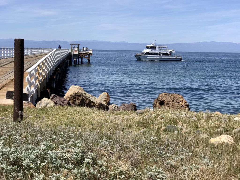
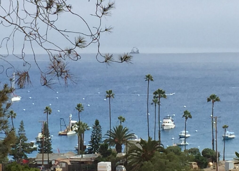
To visit Catalina Island by boat, you can launch from several locations in Southern California. These include Dana Point, San Pedro, and Long Beach156910. The distance you need to travel by sea to reach Catalina Island varies depending on your launch point. For instance, the trip from Long Beach to Catalina Island is approximately 22 miles26.
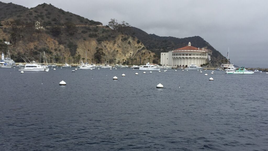
Catalina Island, the southernmost island of California’s Channel Islands, is noteworthy for several reasons. It is made up of two towns, the incorporated city of Avalon on the east end, and the unincorporated village Two Harbors on the west end2.
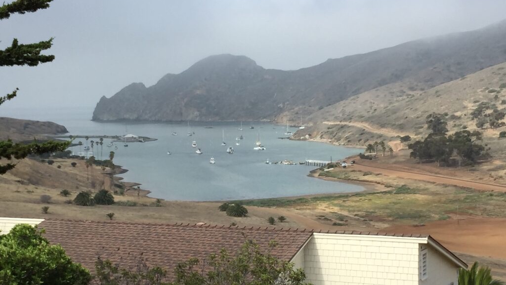
The island is known for its rugged wilderness of majestic beauty, managed by the Catalina Island Conservancy2. It has a rich history, with Avalon being incorporated in 1913 and the Chicago Cubs training on the island from 1921 to 195137. The island is also home to the oldest golf course in Southern California, first built in 18927.
The MacGregor 26x sailboats, which are often used to visit Catalina Island, were built by the MacGregor Yacht Corporation in the United States48. The MacGregor 26x is an American trailerable sailboat that was first built in 19864. Production of these sailboats ended in 20134. The MacGregor Yacht Corporation was in business until early 2013. During its lifetime, MacGregor manufactured over 36,000 yachts8.
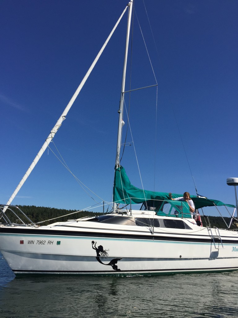
The MacGregor 26x is known for its unique design and features. It is a sail/power ‘hybrid’, designed for use with a more than ‘auxiliary’ sized outboard (up to 100hp if the outboard is of light weight) and water ballast6. It was also designed to be simple to operate, require little maintenance, float even if capsized, and be low-priced, which made it attractive to newcomers to sailing5. Today the vessel is prized by experienced boaters, many with racing as well as military backgrounds. The Macgregor 26X sailboats today are fitted with carbon fiber sails and 90hp four stroke engines. In total, 5000 MacGregor 26x sailboats were built between 1995 and 20036. Despite the end of production, the MacGregor 26x remains a popular model among sailing enthusiasts13.
Tell the Chumash creation story. What marine mammals were harvested in the Channel Islands?
The Chumash creation story begins with the Earth Goddess Hutash, who created the first Chumash people on Santa Cruz Island from the seeds of a magic plant. Hutash was married to the Sky Snake (the Milky Way), who could make lightning bolts with his tongue. One day, the Sky Snake sent down a bolt of lightning, which started a fire on the island grasslands below. This gave the Chumash fire, allowing them to live more comfortably. As the Chumash population grew, the island became crowded, which disturbed Hutash. She decided that some of the Chumash had to leave the island and move to the mainland. Hutash created a Rainbow Bridge for the Chumash to cross to the mainland. However, some of the Chumash looked down while crossing the bridge, became dizzy, and fell into the ocean. To prevent them from drowning, Hutash turned them into dolphins2811.
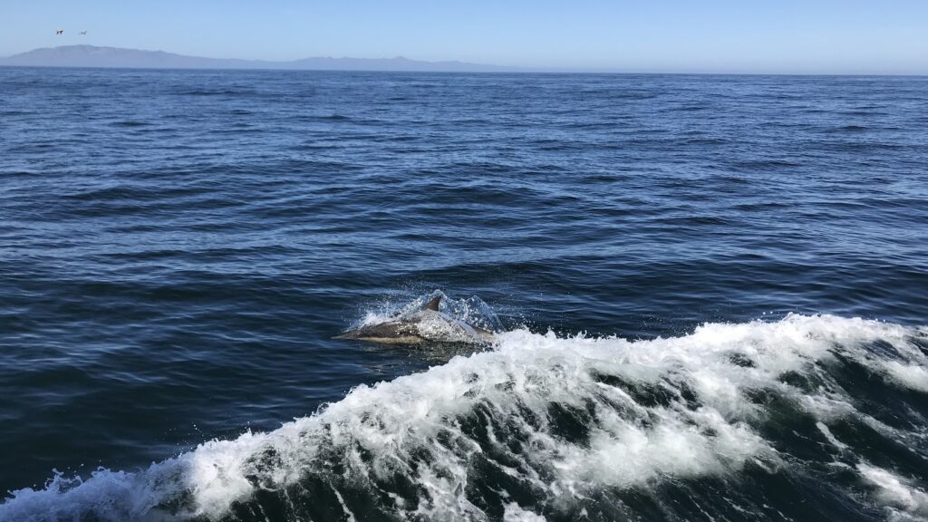
The Channel Islands support a great diversity of marine mammals, including many species of pinnipeds (seals and sea lions) and cetaceans (whales and dolphins) as well as otters. These animals either breed on the islands or feed in the productive waters of the Santa Barbara Channel39.
Military activity occurs on the islands of San Clemente and San Nicolas. What kind of military activity occurs there today and how were these islands used during WW2 and Vietnam? Describe the testing of PBRs built by Uniflight
San Clemente Island, one of the Channel Islands off the coast of Southern California, has a long history of military activity and weapons testing. The island is currently the U.S. Navy’s only active ship-to-shore weapons training facility in the world1.
It has been used for various purposes, including research and development of Navy weapon systems, tactical training, and testing of missiles and other equipment3.
During World War II, San Clemente Island served as a training ground for amphibious landing craft, which were crucial for the island hopping strategy usedto attack Japanese-occupied islands in the Pacific5. In the 1950s and 1960s, the island was involved in the testing of Polaris-program rockets, and in February 1969, the SEALAB III project took place off the coast of San Clemente5.
During the Vietnam War, the US Navy developed three inshore task forces to adapt to the low-tech, manpower-intensive nature of the conflict4. These forces, including riverboats and destroyers, were responsible for conducting maritime blockades and engaging Viet Cong units in the Mekong Delta and other areas4.

One specific testing activity on San Clemente Island was the testing of PBRs (Patrol Boat, River) built by Uniflight. The testing of these boats on San Clemente Island was part of the Navy’s research and development efforts to improve their performance and effectiveness6. PBRs were widely used by the US Navy during the Vietnam War for riverine operations, including patrol, interdiction, and fire support missions4.
750 PBRs were minted directly from Uniflite 31 foot Sports Sedan molds in Belingham Washington in the 1960s and at least 300 of the Uniflite patrol boats saw duty in Vietnam. The four man PBR crews were trained near Catalina Island in Coronodo, south of the MacGregor Yachts factory,
Speed, Stronge, Flotation = Safety
For the Vietnam War, approximately 300 PBRs (Patrol Boat, River) were produced by Uniflite, a boatyard in Bellingham, Washington, on the northern end of Puget Sound near the Canadian border1. The initial 11 PBRs were delivered in March 1966, with the rest being delivered over the next few years to the U.S. and South Vietnamese military1. The PBRs were based on a pleasure boat design constructed by Uniflite1.
- The company was named Uniflite because it aimed to produce a unified line of boats, combining the best features of various boat types1.
- Not all PBRs were made in Washington State. Some were also built in other locations, including the Philippines and Vietnam1.
- All PBRs were equipped with water jet propulsion, powered by twin Detroit 6V53 engines5.
- The primary weapons mounted on PBRs were two .50 caliber machine guns and an 81mm mortar15. These weapons were used for engaging enemy forces and providing fire support during riverine operations.
- The testing of PBRs’ weapons was not specifically mentioned in the search results. However, San Clemente Island, as a U.S. Navy training facility, was involved in various weapons testing activities, including those related to PBRs.
Ronald Reagan and Wriggly are important in Catalina Island History and so are Bogart and Wood. Why is that. What famous people have frequented Catalina Island?
Ronald Reagan, the 40th President of the United States, had ties to Catalina Island through his early career as a sports announcer for the Chicago Cubs, whose spring training took place on the island. from 1921-1941 and then from 1946-1951. Reagan visited the island during this time and it was here that he also lined up his debut film role410. His time on Catalina Island marked the beginning of his career as an actor, which eventually led to his presidency17.
William Wrigley Jr., the chewing gum magnate, bought nearly every share of the Santa Catalina Island Company in 1919, gaining a controlling interest. He invested millions in his vision to create a “playground for all” on Catalina Island, building infrastructure, a reservoir, Hotel Atwater, Bird Park, and other attractions.

In 1929, Wrigley built the iconic Catalina Casino, which boasts the world’s largest circular ballroom and the first theatre designed and built to show talking motion pictures. His descendants still own the Catalina Island Company and carry on his vision to create a world-class island resort25811.
The island became a popular retreat for movie stars in the early 1900s. Catalina Island was a popular retreat for Hollywood’s elite during the 1930s, 40s, and 50s, attracting many famous actors and actresses236712. Notable visitors included Charlie Chaplin, Humphrey Bogart, Errol Flynn, and Winston Churchill. John Wayne was also a frequent visitor to the island610.

Humphrey Bogart had a particular fondness for sailing around Catalina Island. He bought a 55-foot sailing yacht, the Santana, from actor Dick Powell in 1945 and spent about 30 weekends a year on the water. Bogart and his wife, actress Lauren Bacall, often fished and explored the island’s many coves, enjoying the tranquility of Catalina’s waters9.

Did Natalie Wood drown off Catalina Island? What anchorage did the drowning take place?
Natalie Wood, a renowned Hollywood actress, tragically drowned off the coast of Catalina Island on November 29, 1981. She was on a yacht with her husband, Robert Wagner, and co-star Christopher Walken during a break from the production of her film, Brainstorm1. The yacht, named Splendour, was anchored off Catalina Island when the incident occurred2.
Wood’s body was found floating in the Pacific Ocean about a mile away from the yacht, 200 yards off Blue Cavern Point on Catalina Island2.The cause of her death was ruled as accidental drowning and hypothermia by Los Angeles County coroner Thomas Noguchi. However, the case was reopened in 2011 due to new information, and the cause of death was changed to “drowning and other undetermined factors”3.
Despite the official ruling, the circumstances surrounding Wood’s death have been a subject of speculation and controversy. Some have questioned why she would have left the yacht on her own by dinghy, given that she could not swim and had a lifelong fear of water1. Others have pointed to new evidence suggesting that she might have been assaulted before she drowned3. However, no definitive conclusions have been reached, and the mystery surrounding Natalie Wood’s death endures to this day3.
The Tragic End of Natalie Wood
Natalie Wood, probably best known for her role in West Side Story, traveled to Catalina Island in 1981 with her husband Robert Wagner and her recent co-star Christopher Walken. It had been rumored that Natalie Wood was having an affair with Christopher Walken. When the group arrived at Catalina Island they were in an argument and Natalie Wood chose to stay on the island the first night rather than on the boat. The next day they spent the day drinking on the island before returning to their boat in the evening, where the arguing continued. The evening of November 28, 1981, Natalie Wood went to her room. She was later found a mile away from the boat. Her death by drowning was ruled an accident. The case was reopened in 2011 and her death certificate was amended to list undetermined factors.
Catalina Island: Six Degrees of Separation from Hollywood
Was Catalina island uniquely positioned for a radio tower? Does the island still have the radio tower?
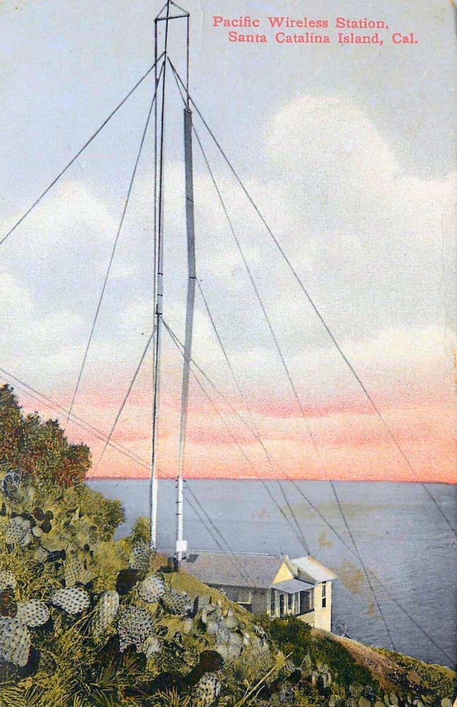
Catalina Island is uniquely positioned for a radio tower due to its location off the coast of Southern California. The island’s high peaks and proximity to the mainland made it an ideal site for radio transmission and communication purposes14.
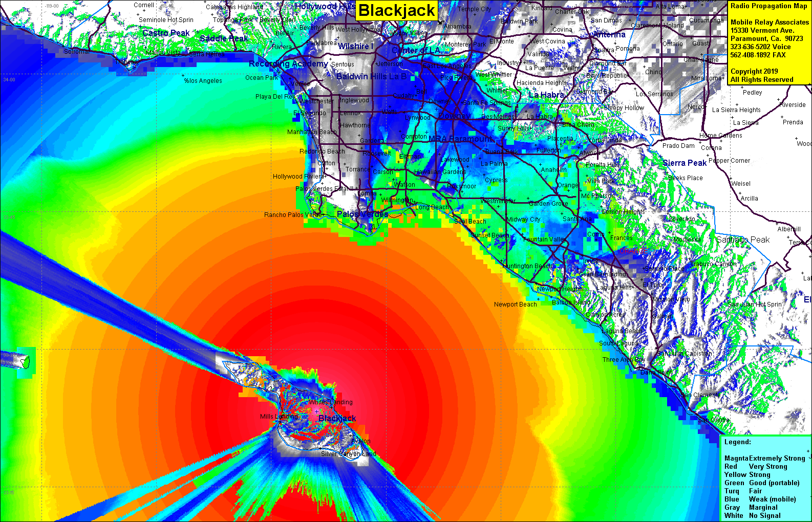
The island still has radio towers today, which play a crucial role in communication capabilities for various entities, including the Los Angeles Port Police and other first responders. One of the radio tower sites is located on Blackjack Mountain, the highest peak on Catalina Island23. Another radio tower site, known as Tower Peak, is situated in Avalon, providing additional coverage for the island5.
The pioneer ham radio operator who built the first radio broadcasting station on Catalina Island was Don C. Wallace, also known as 6BX13. He worked as a U.S. Deputy Fish and Game Warden on the island and was responsible for establishing the wireless communication system between Catalina and the mainland in 19021.
The history of radio on Catalina Island dates back to the early 20th century when the first regular daily wireless radio station in the United States was built in 19021. This wireless station, operated by the Pacific Wireless Telegraph Company, transmitted and received Morse code signals between Catalina and the mainland of Los Angeles County5. The station consisted of an office and a tall transmitting tower located on the ridge of Northwest Hill above Avalon5. The wireless telegraph technology was a novelty and immediately popular among Catalina residents and visitors5.
This station consisted of an office and a tall transmitting tower, which played a significant role in communication between the island and the mainland6. The presence of these radio towers has been instrumental in facilitating communication and connectivity for Catalina Island and its surrounding areas.
[flagallery gid=1]
The first European to discover the Channel Islands was the Portuguese explorer Juan Rodríguez Cabrillo in 15424. At the time, the area was inhabited by the Chumash people, who called Anacapa Island “Anyapax,” meaning “illusion”3. The islands were named after saints by subsequent explorers, including English Captain George Vancouver, who fixed the present names of the islands on nautical charts in 17934.Here is the story of each saint associated with the Channel Islands:
- San Miguel Island: Named after Saint Michael the Archangel, the island was originally called “Miquel” by the Chumash people4.
- Santa Rosa Island: Named after Saint Rose of Lima, the first Catholic saint of the Americas4.
- Santa Cruz Island: Named after the Holy Cross, the island was originally called “Limuw” by the Chumash people4.
- Anacapa Island: The only island with a non-Spanish-derived name, Anacapa comes from the Chumash word “Anyapax,” meaning “illusion”3.
- Santa Barbara Island: Named after Saint Barbara, the patron saint of sailors and gunners4.
The Santa Barbara Channel, where the Channel Islands are located, is adjacent to the Channel Islands National Park. The park protects five of the eight Channel Islands, including Anacapa, Santa Cruz, Santa Rosa, San Miguel, and Santa Barbara, and their surrounding ocean2.
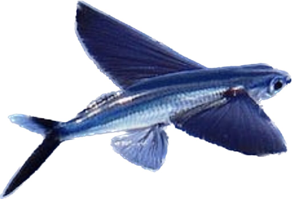
Can you get a boat in Avalon to see the flying fish fly? What time of year? Do the fish fly only at night? Can you see the state fish in a submarine from Avalon? What other interesting fish can be seen in the Channel Islands National Park. Is there a channel other than Santa Barbara Channel in Channel Islands National Park? How was the park named and why?
In Avalon, Catalina Island, you can experience a unique flying fish tour during the summer months. The flying fish tours are typically conducted at night, as the fish are more active during this time. The tours are available from June through September, with a duration of approximately 50 minutes12. The fish are attracted to the boat’s powerful searchlight, which entices them to take flight and soar across the surface of the sea1.
The state fish of California, the Garibaldi, can be seen while snorkeling or diving in the waters of the Channel Islands. Seeing the Garibaldi from a submarine or glass bottom boat is also possible in the park3.
Other interesting fish that can be seen in the Channel Islands National Park include kelp bass, sheephead, and various species of rockfish. The park is known for its diverse marine life and is often referred to as the “Galapagos of North America”3.
The park is situated in the Santa Barbara Channel, which separates the mainland from the Channel Islands4.The park was named the Channel Islands National Park in 1980 to preserve and protect the unique natural and cultural resources of the area. The islands are home to a rich history, including Native American settlements, European exploration, and military activities during World War II5.
In the heart of the Pacific’s grand expanse,
Lie the Channel Islands, in a sunlit dance. Eight jewels of nature, each with a tale, Preserved and protected, against the gale.
San Miguel, named for the archangel’s might, Guardian of heaven, in the celestial night. Santa Rosa, for Saint Rose so divine, Her love for the poor, like a beacon does shine.
Santa Cruz, the island of the Holy Cross, A sanctuary of life, amidst the ocean’s toss. Anacapa, the Chumash’s ‘mirage’ so bright, A shimmering illusion, in the moon’s soft light.
Santa Barbara, named for the saint so bold, Patron of the thunder, in the tales of old. San Nicolas, for the saint of sailors’ care,
Guiding them safely, through the ocean’s glare.
Santa Catalina, for Saint Catherine so wise, Her faith and courage, reaching to the skies. San Clemente, for the saint of peace and love,
A symbol of unity, like the stars above.
The Chumash once tread on these sacred lands, Living in harmony with nature’s demands. Their spirits still whisper in the ocean’s roar,
Echoes of a time, from the days of yore.
Yet a shadow looms, a threat so real, The relentless pursuit of the fossil fuel deal. Oil rigs stand tall, in the water so clear, A stark reminder of what we hold dear.
But the islands stand strong, in the face of the storm, A beacon of hope, in its purest form. For the Channel Islands, in their silent plea,
Remind us all, of how beautiful our world can be.
So let’s stand together, for preservation’s cause, To protect these islands, without a pause. For the Channel Islands, in their majesty, Are a treasure to cherish, for eternity.


