In a remote corner of eastern Oregon, striped hills of red, gold, and black preserve one of the world’s great records of natural climate change — and a lesson for understanding the human-caused warming now reshaping the planet.
SECTION 01
A National Monument, Not a National Park
The Painted Hills are one of three units of John Day Fossil Beds National Monument in eastern Oregon, alongside Sheep Rock and Clarno.
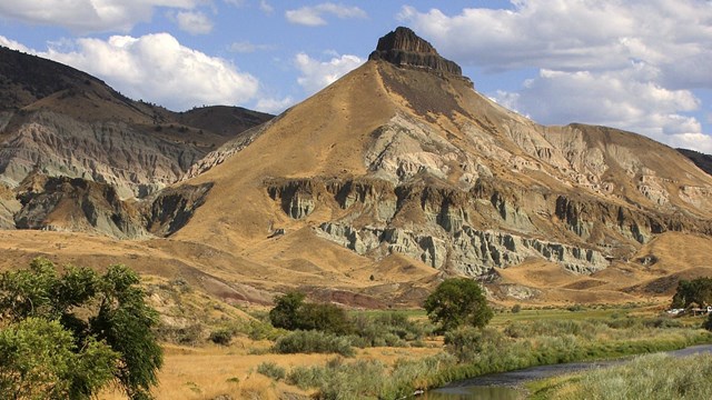
The monument is not a national park: Congress authorized it in 1974, and after the State of Oregon transferred three predecessor state parks to the federal government, it was formally established on October 8, 1975.[1][2] The monument spans roughly 14,000 acres of the John Day River valley, and the Painted Hills Unit — 3,129 acres about 9 miles northwest of the town of Mitchell — is the most visited of the three.[3][4]
SECTION 02
What the Colors Mean
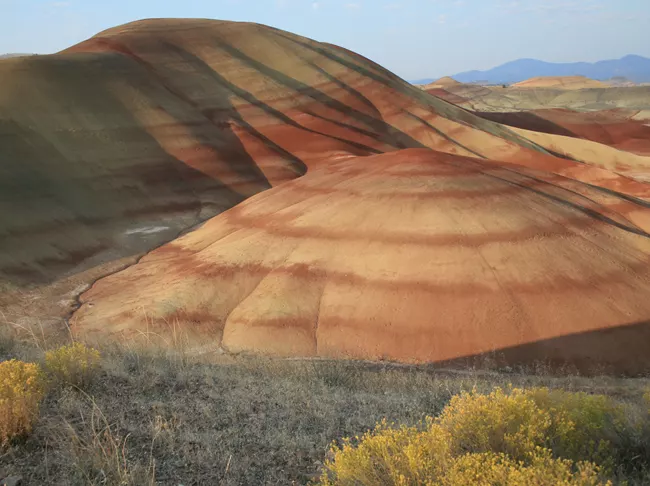
The hills are striped in red, tan, orange, black, and gold because they are exposed paleosols — fossilized ancient soils — interleaved with floodplain mudstones and lake sediments of the John Day Formation. The red layers are lateritic soils that formed under warm, humid conditions; the gray bands are mudstone and siltstone deposited on ancient floodplains; and the black layers are carbonized plant matter (lignite) that accumulated in swamps.[5][6]
The unit also preserves the Bridge Creek Flora — a diverse assemblage of leaf fossils between 39 and 30 million years old — and a small outcrop of animal fossils from 30 to 27 million years ago.[3] Collecting fossils or any natural material is strictly prohibited, and the monument protects the paleosols because ongoing research depends on them.[7]
SECTION 03
Ancient Climate Change — All Natural
The Painted Hills are, in effect, a climate archive. The wider John Day fossil record spans tens of millions of years of the “Age of Mammals and Flowering Plants,” from roughly 44 to 7 million years ago.[7] It begins in a very different Oregon: warm, wet, and subtropical, with paratropical forests, lakes, and swamps that resembled parts of today’s southeastern United States or China.[6][8]
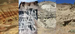
The record preserves a long-term trend of cooling and drying, with a dramatic transition around 34 million years ago at the Eocene–Oligocene boundary — the shift from Earth’s “greenhouse” state to its “icehouse” state. In the fossil soils, the change is visible and abrupt: red, deeply weathered tropical-type soils give way to the gray and tan soils of a cooler, drier, more seasonal climate.[9][10] Cooling and drying continued in steps afterward: hardwood forests gave ground to grasses and, eventually, to the sagebrush steppe of today’s semi-arid landscape.[6][11]
Scientists reconstruct these ancient climates from the fossil plants and from the chemistry, mineralogy, and degree of weathering in the paleosols, with datable volcanic ash layers pinning the sequence in time — not from the colors alone.[8][10]
None of this involved people. The leading explanation for the Eocene–Oligocene transition is a gradual decline in atmospheric carbon dioxide — from roughly 1,000–800 ppm down to 700–600 ppm — which allowed a continental-scale Antarctic ice sheet to grow.[12] Research on Antarctic ice-sheet history finds the large, stable ice sheet took hold as CO₂ fell below about 600 ppm.[13] Contributing factors included changes to ocean gateways — including the opening Drake Passage and the Antarctic Circumpolar Current — and orbital variability that paced the ice growth.[14]
SECTION 04
And the Human-Caused Part
The warming happening now is a separate event — and it is human-caused. The Intergovernmental Panel on Climate Change’s Sixth Assessment concludes it is “unequivocal that human influence has warmed the atmosphere, ocean and land,” that greenhouse gas increases since 1750 are “unequivocally caused by human activities,” and that the best estimate of human-caused warming in 2010–2019, relative to 1850–1900, is about 1.07 °C.[15]
The National Park Service applies this directly to John Day Fossil Beds. The park’s climate action plan identifies greenhouse gas buildup as the leading cause of current warming, warns that rising temperatures and shifting precipitation may alter the monument’s vegetation, habitats, and visitor experience, and draws the crucial distinction in pace: the climate changes recorded in the fossil beds typically unfolded over many thousands of years, while current change is far more rapid — potentially giving species too little time to adapt or migrate.[16]
The fossil record of the John Day country shows three responses to climate change: species adapted, migrated, or went extinct. The third is permanent.[16]
That is the deepest insight the Painted Hills offer a visitor: a record of past ecosystem responses to natural climate change, against which the speed of today’s human-driven change stands out sharply.
SECTION 05
The Hills Through Six Eyes
THE HISTORIAN
The region’s fossil record was recognized in the 1860s by Thomas Condon, a frontier minister and self-taught geologist whose discoveries drew expeditions from Yale, Princeton, and the Smithsonian; Oregon began buying land for state parks here in 1931, and the monument campaign followed in the 1960s and ’70s.[2][17]The Cant Ranch Museum at the Sheep Rock Unit, about an hour away, covers the homestead and ranching era.[3]
THE ARCHITECT
The hills are a study in natural layering, color, and horizontal rhythm — an inspiration source for earth-toned palettes and landform-conscious design. The Painted Cove Trail’s boardwalk, built to protect fragile soils, is a restrained example of landscape architecture deferring to its site.[18] (A creative observation, not a documented architectural tradition.)
THE SCIENTIST
The wider John Day region holds one of the longest, most continuous terrestrial records of ecosystem and climate change anywhere, and the monument remains an active research site with its own paleontology center.[4][19]Evidence from these soils and fossils documents the shift from wet subtropical conditions to cooler, drier climates after about 33 million years ago.[8]
THE HIKER
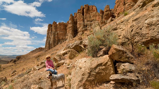
Five short trails, each with its own parking area:[20]TRAILDISTANCENOTESPainted Cove0.25 mi loopCrimson and gold hills; boardwalk at the trailhead is wheelchair accessible, the loop beyond includes five stepsPainted Hills Overlook0.5 mi round tripLevel old road; classic panorama, best light late afternoonLeaf Hill0.25 mi loopLoop around an extensively excavated fossil-leaf hillRed Scar Knoll0.25 mi trailStriking half-red, half-tan claystone hillCarroll Rim1.6 mi round trip400-ft climb to the best full panorama
THE MUSICIAN
For a musician, the striped bands can read like a visual score, and the quiet, wind-swept basin is a natural place to compose or record — a creative suggestion the landscape invites. The park has hosted sunset and night-sky programs at the hills.[21]
THE CHILD
The Painted Cove boardwalk through candy-colored hills, spring wildflowers growing in the hill ripples, and a shaded picnic area make it kid-friendly.[3][22]For fossils in display cases, the Thomas Condon Paleontology Center at the Sheep Rock Unit is about a 45-mile drive.[23]
SECTION 06
The Man Behind the Name
John Day (about 1770–1820) was an American hunter and fur trapper, born in Virginia, who joined John Jacob Astor’s Pacific Fur Company expedition and reached Oregon in 1812.[24]In April 1812, near the mouth of a Columbia tributary, he and Ramsay Crooks were robbed of their rifles, equipment, and clothing by Native people — retaliation for a murder committed by another company employee. The men survived, and fur-company employees began calling the nearby stream the John Day River.[25]
From the river’s name came the monument, the John Day Formation that produces the Painted Hills’ colors, the John Day Dam, and the towns of John Day and Dayville.[24] The man himself never found a fossil here, or even visited the area.[26] He died on February 16, 1820, at a winter camp during a fur-trapping expedition into the Snake Country, and was buried there — recent research suggests somewhere below Fallert Springs in present-day Idaho, though the exact site remains uncertain.[24]
SECTION 07
The First Peoples and Living Communities
The monument sits within the Columbia Plateau culture area, where people spoke Sahaptin languages. The John Day River watershed was held mostly by the Tenino, or Warm Springs peoples — including a distinct “John Day band” whose seasonal round of river fishing, hunting, and root and berry gathering is described in the park’s historic studies.[27] The Painted Hills and Clarno units appear to fall within the Tenino culture area, while Northern Paiute people from the Great Basin occupied the Sheep Rock area in the early historic period; territories overlapped.[28] To the east lived the Cayuse, Umatilla, and Walla Walla peoples.[29] The tribal identity of the group involved in the 1812 encounter was never recorded.[26]
Under the 1855 treaties, the tribes ceded the John Day country, and most of the Sahaptin-speaking people of the watershed likely relocated to the Warm Springs Reservation.[29] Today two federally recognized nations carry these identities forward: the Confederated Tribes of Warm Springs (Warm Springs, Wasco, and Paiute) on a 644,000-acre reservation,[30]and the Confederated Tribes of the Umatilla Indian Reservation (Cayuse, Umatilla, and Walla Walla) near Pendleton.[31]
Two tribal destinations pair a world-class museum with a casino. On US-26 at Warm Springs, the Museum at Warm Springs holds one of the largest and most complete collections of Plateau Native American artifacts in the country,[32] and across the highway the tribe’s Indian Head Casino was designed to resemble the historic fishing scaffolds at Celilo Falls.[33] Near Pendleton off Interstate 84, the Tamástslikt Cultural Institute tells the story of the Cayuse, Umatilla, and Walla Walla in three acts — “We Were,” “We Are,” “We Will Be” — on the grounds of the tribe’s Wildhorse Resort & Casino.[34] They lie in opposite directions from the Painted Hills — Warm Springs to the west, Pendleton to the northeast — so choose one along your route, and confirm hours and admission on each museum’s site before visiting.
SECTION 08
Getting There
The unit is about 9–10 miles northwest of Mitchell, Oregon (address: 37375 Bear Creek Road). From Highway 26, turn north on Burnt Ranch Road three miles west of Mitchell, drive six miles, then turn left onto Bear Creek Road into the monument.[23] Roads inside the unit are dirt and gravel, one way in and out, and large RVs are not recommended past the Overlook.[35] The three monument units are an hour or more apart by winding roads; Sheep Rock to Painted Hills is 45 miles.[23]
There is no entrance fee or pass required,[36] no visitor center at this unit,[23] and no cell service (wifi is available only at the picnic area). Stay on trails — walking on the hills and collecting fossils or rocks are strictly prohibited.[7] The colors are most vivid in late-afternoon light, and seasons change the palette dramatically, from spring wildflowers to winter snow stripes.[3]
Footnotes
- National Park Service, “Fossils of the 2025 National Fossil Day Artwork” — establishment on October 8, 1975 and 13,944-acre extent. ↩
- Wikipedia, “John Day Fossil Beds National Monument” — 1974 authorization and state-park land transfers. ↩
- National Park Service, “Painted Hills Unit” — unit description, Bridge Creek Flora, seasonal colors. ↩
- National Park Service, “Foundation Document Overview” — 14,000 acres, Painted Hills Unit size and paleosols. ↩
- U.S. Geological Survey, “Painted Hills Overlook Trail” — paleosol layer colors and origins. ↩
- National Park Service, “John Day Strata” — cooling and drying trend, ancient environments. ↩
- National Park Service, “Basic Information” — regulations, services, fossil record timespan. ↩
- Oregon Secretary of State, “John Day Fossil Beds National Monument” — climate history of the formations. ↩
- National Park Service, “Geology and Paleoenvironments of the Clarno Unit, Chapter 2” — abrupt Eocene–Oligocene paleosol change. ↩
- Bestland & Retallack, NPS geology study — hothouse-to-icehouse transition and paleosol evidence. ↩
- National Park Service, “Upper John Day Assemblage” — spread of grasslands and sagebrush steppe. ↩
- PNAS, “The enigma of Oligocene climate and global surface temperature evolution” — CO₂ decline across the transition. ↩
- Science, “Antarctic Ice Sheet variability across the Eocene-Oligocene boundary” — ice-sheet growth and CO₂ levels. ↩
- Wikipedia, “Eocene–Oligocene extinction event” — ocean gateway and orbital factors. ↩
- IPCC, “AR6 WGI Summary for Policymakers” — human attribution of current warming. ↩
- National Park Service, “John Day Fossil Beds Climate Friendly Parks Action Plan” — climate risks to the monument and past species responses. ↩
- National Park Service, “Historic Resources Study, Chapter 7” — state park acquisitions and monument campaign. ↩
- National Park Service, “Painted Cove Trail” — boardwalk accessibility details. ↩
- National Park Service, “John Day Fossil Beds National Monument” — active paleontology research center. ↩
- National Park Service, “Painted Hills Unit Trails” — official trail list and distances. ↩
- National Park Service, “Hot Spot Event with Leave No Trace at Painted Hills” — sunset and night-sky programs. ↩
- National Park Service, “Audio Description, Page 3” — unit amenities and trail descriptions. ↩
- National Park Service, “Directions & Transportation” — driving directions, no visitor center at the unit, and unit distances. ↩
- Oregon Encyclopedia, “John Day (1770?–1820)” — biography and place-names. ↩
- Oregon Encyclopedia, “John Day River (north-central Oregon)” — the 1812 naming incident. ↩
- National Park Service, “Frequently Asked Questions” — John Day never visited; 1812 attackers unidentified. ↩
- National Park Service, “Historic Resources Study, Chapter 1” — the John Day band’s seasonal round. ↩
- National Park Service, “Administrative History, Chapter 1” — Tenino and Northern Paiute connections. ↩
- National Park Service, “Historic Resources Study, Chapter 4” — 1855 treaties and reservation relocation. ↩
- Travel Oregon, “Confederated Tribes of Warm Springs” — reservation and member tribes. ↩
- Confederated Tribes of the Umatilla Indian Reservation, “Bomb Threat Closes Tamástslikt Cultural Institute” — CTUIR composition and governance. ↩
- Visit Central Oregon, “Warm Springs, Oregon” — Museum at Warm Springs collections. ↩
- Confederated Tribes of Warm Springs, “Indian Head Casino” — ownership and Celilo Falls design. ↩
- Travel Oregon, “Tamástslikt Cultural Institute” — exhibits and tribal perspective. ↩
- National Park Service, “Alerts & Conditions” — road and RV advisories. ↩
- National Park Service, “Plan Your Visit” — no entrance pass required. ↩